
Industrial Brief
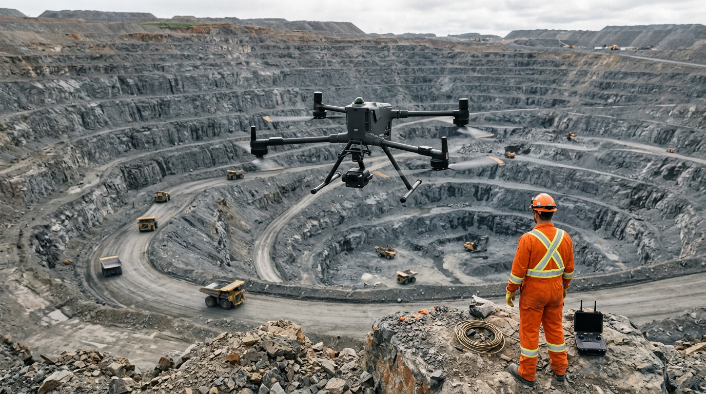
DJI Matrice 400 for Mining in Canada: Survey, Slope & Safety
How the DJI Matrice 400 handles mine survey, high-wall monitoring, and site safety in Canadian conditions — verified specs, real use cases, and what to know before you fly.
Remote Robotic · July 14, 2026 · 8 min read
Last verified against DJI's published Matrice 400 specifications: July 2026.
Why the Matrice 400 Fits Mining Work
Mining is hard on equipment before it's hard on the operator. Dust coats everything. High-voltage plant and steel infrastructure throw off magnetic interference. Sites sit at elevation, run cold half the year, and stretch the distance between an operator and the asset being surveyed. The gear either holds up in those conditions or it becomes shelfware.
The Matrice 400 was specified for exactly this envelope. It carries an IP55 ingress rating, operates from -20°C to 50°C, and its built-in RTK module is rated to withstand strong magnetic interference from metal structures and high-voltage lines — the kind you find around a processing plant or a substation feeding a mill. That last detail matters more than it sounds: RTK positioning is what makes survey data trustworthy, and interference is what corrupts it.

DJI Matrice 400 Key Specifications for Mining
| Specification | DJI's published figure |
|---|---|
| Max flight time (no wind) | 59 min |
| Max hover time | 53 min |
| Max flight distance | 40 km |
| Max payload | 6 kg (third gimbal connector, at sea level) |
| Max takeoff weight | 15.8 kg |
| RTK positioning accuracy | 1 cm + 1 ppm (horizontal), 1.5 cm + 1 ppm (vertical) |
| Hovering accuracy (RTK) | ±0.1 m horizontal and vertical |
| Rotating LiDAR | 360° × 58°, 520,000 points/sec, 0.5–100 m range |
| mmWave radar | Detects a 21.6 mm power line at 50 m |
| Operating temperature | -20°C to 50°C |
| Max takeoff altitude | 7,000 m |
| Max wind resistance | 12 m/s (takeoff and landing) |
| Ingress protection | IP55 |
| Transmission range | 40 km FCC / 20 km CE (DJI O4 Enterprise Enhanced) |
| Airborne ADS-B In | Receives manned-aircraft broadcasts to 20 km |
| Battery | TB100, 977 Wh, 400-cycle rating |
Per DJI's footnotes, flight-time and range figures were measured in controlled, windless conditions carrying a specific payload and are reference data — real-world numbers vary with wind, altitude, payload, and firmware. The 6 kg payload figure is measured at the third gimbal connector at sea level and decreases as altitude increases, which is worth planning around for high-elevation sites.

What Can the Matrice 400 Do on a Mine Site?
Six jobs cover most of what a mine flying program actually needs. Each one below maps to a specific, verified capability — not a general "drones are useful" claim.
1. High-Wall and Slope Monitoring
Rock engineers need repeatable, close-range data on pit walls without sending anyone to the base of an active face. The Matrice 400 has a dedicated Slope Route flight mode built for single-elevation photogrammetry — you verify the plan against an AR projection of the actual slope before you commit, and the aircraft holds an RTK fix through the whole flight. The 360° rotating LiDAR and 200 m obstacle detection let it work tight to a wall safely, and the 6 kg payload carries a LiDAR sensor like the DJI Zenmuse L3 for the point cloud.
Why it matters: a repeatable, georeferenced slope model beats a spot check from the crest, and nobody stands under a wall to get it.
2. Stockpile and Volumetric Surveying
Stockpile counts have to reconcile against production, not just look about right. The aircraft's Ortho Collection route gives you direct control over ground sampling distance, image overlap, and elevation optimization — the settings that decide whether a reconstruction is survey-grade. Paired with the DJI Zenmuse P1 full-frame photogrammetry payload, RTK-tagged imagery cuts the dependence on laying ground control points across a live pit, and 59-minute endurance covers large run-of-mine pads and waste dumps without a mid-job battery swap.
Why it matters: fewer ground control points and fewer landings mean faster turnarounds on the volumetrics your month-end depends on.
3. Blast Zone and Exclusion-Area Inspection
Post-blast assessment inside an exclusion zone is exactly the work you want to do from the air. Airborne ADS-B In flags manned aircraft up to 20 km out, and PinPoint with laser rangefinding tags a hazard's latitude, longitude, and altitude directly from the flight — so you're marking loose ground or a hung face with coordinates, not a hand wave.
Why it matters: you clear and document a zone without putting a spotter inside it.
4. Fixed and Mobile Equipment Thermal Inspection
Conveyor idlers, transformers, and crusher motors run hot before they fail. The Matrice 400's dual gimbal connector carries two sensors on one flight (950 g per mount), so a thermal-and-visual payload like the DJI Zenmuse H30T captures a heat signature and its visual context together instead of two trips to the same asset. Starlight-grade night vision on the FPV camera supports after-dark checks.
Why it matters: catch a bearing or a connection before it takes a conveyor line down mid-shift.
5. Perimeter and Low-Light Security
A large lease boundary is hard to patrol consistently on the ground. The aircraft's 40 km range and 40 km transmission cover a lot of fence line, the full sensing stack stays live after dark, and Dual Operator Mode lets one pilot fly the route while a second operator runs the camera independently.
Why it matters: consistent overnight coverage of haul roads and boundaries without adding ground patrols.
6. Remote-Site Survey Without a Base Station
Greenfield and remote leases often have no established RTK base. Custom Network RTK connects to an NTRIP server over cellular or Wi-Fi to replace a physical base station, or set up your own reference on site with the DJI D-RTK 3 Multifunctional Station for centimetre positioning where there's no network coverage. Enhanced Transmission blends the O4 link with 4G so control quality doesn't hinge on line-of-sight radio through broken terrain.
Why it matters: survey-grade positioning on a site that has no survey infrastructure yet. For a deeper look at the transmission stack, see our field note on the DJI O4 Ground Station.
What About Flying Near People or Over Crews?
This is where Canadian operators need to be precise. Mine sites have crews working below flight paths, and the rules for flying near or over people run through Transport Canada — not through the aircraft's spec sheet.
The Matrice 400's 15.8 kg maximum takeoff weight keeps it in the small-RPAS class (250 g to 25 kg), so operating near or over people is an advanced operation under CARs Part IX. That requires a pilot certified for Advanced Operations, compliance with the category rules including NAV CANADA authorization in controlled airspace, and a valid RPAS Safety Assurance declaration covering that specific operation. Eligibility is model- and operation-specific, so confirm your regulatory footing before planning any work near crews — ask us and we'll help you match the aircraft configuration to the operation you actually need to fly. Our RPAS training and ROC support covers the pilot side.
Does the Cold Kill the Flying Season?
No. The Matrice 400 operates to -20°C, the TB100 battery supports low-temperature self-heating charging, and the airframe carries an IP55 rating for dust and rain. Battery capacity drops in the cold, which shortens flight time and reduces wind-resistance headroom, so plan shorter flights and warm the batteries before takeoff — but the flying season doesn't end at the first frost.

Which Payload for Which Mining Job?
| Mining job | Payload / hardware | Remote Robotic catalog |
|---|---|---|
| Stockpile volumetrics, terrain models | LiDAR | DJI Zenmuse L3 |
| High-wall / slope point clouds | LiDAR | DJI Zenmuse L3 |
| Photogrammetry mapping, orthomosaics | Full-frame camera | DJI Zenmuse P1 |
| Equipment thermal + visual inspection | Zoom + thermal | DJI Zenmuse H30 Series |
| Blast-face and asset documentation | Zoom + thermal | DJI Zenmuse H30 Series |
| RTK positioning, no network coverage | Base station | DJI D-RTK 3 Multifunctional Station |
Payload availability and current Canadian pricing are quote-only — contact us to confirm the configuration for your site before ordering. If a job needs a payload combination not listed here, we'll spec it against what's actually available for the Matrice 400 rather than guess. For the full L3 survey stack, see our companion field note on the Matrice 400 + Zenmuse L3 survey kit.
The Bottom Line for Canadian Mine Operators
The Matrice 400 earns its place on a mine site by covering the widest range of work on a single, weather-hardened airframe: survey-grade RTK for volumetrics, a dedicated Slope Route mode for high walls, dual-payload thermal inspection, and a sensing stack that keeps flying through dust. The endurance and range mean fewer battery swaps across a large lease, and the cold-weather envelope keeps it working through a Canadian winter.
Two things to settle before you commit: match the payload to the jobs you actually run (LiDAR for survey and slopes, the Zenmuse P1 for photogrammetry mapping, thermal for equipment, and a D-RTK 3 station where there's no network coverage), and confirm your regulatory footing for any work near crews before you plan it — that runs through Transport Canada, not the spec sheet.
If you're scoping the Matrice 400 for a Canadian mining program, talk to us. We'll match aircraft and payload configuration to the work you actually need to fly, and we carry the platform for the Canadian market.
Comparing platforms? See the pillar guide: DJI Drones for Mining & Surveying: The Complete Canadian Guide.
Sources
- DJI Matrice 400 specifications: enterprise.dji.com/matrice-400/specs
- DJI Matrice 400 User Manual v2.0 (Slope Route, RTK, sensing systems, IP rating, Cx certification)
- Transport Canada, Drone operation categories and pilot certificates: tc.canada.ca
Shop the story
Related products in our catalog
Every product below is stocked and supported by Remote Robotic in Canada.
- DJI Matrice 400
DJI Matrice 400
Flagship enterprise M400 airframe — 59 min flight, 6 kg payload, multi-sensor ready.
View product → - DJI Zenmuse L3
DJI Zenmuse L3
1535 nm long-range LiDAR + dual 100 MP RGB — survey-grade M400 mapping payload.
View product → - DJI Zenmuse H30T
DJI Zenmuse H30T
Wide + 34× zoom + thermal (1280×1024) + laser rangefinder + NIR — the flagship M400 payload.
View product → - DJI Matrice 4TD
DJI Matrice 4TD
Dock-native thermal M4TD with NIR aux light — night-ops DFR and thermal patrol.
View product → - DJI Zenmuse S1 Spotlight
DJI Zenmuse S1 Spotlight
10,000-lumen LEP spotlight for M400 — search & rescue, security, night inspection.
View product →