Survey Guide
LiDAR Drones for Surveying & Mapping in Canada
How drone LiDAR supports Canadian corridor, stockpile, construction, and forestry surveys—and why Matrice 400 with Zenmuse L3 is our lead recommendation.
Remote Robotic · September 24, 2026 · 4 min read
Last verified: September 2026.
Canada's geography is exactly the kind of problem LiDAR drones were built to solve. Long linear corridors, vast distances, and terrain that swallows a ground crew's schedule — LiDAR-equipped drones have gone from novelty to standard survey tool for exactly that reason.
Why LiDAR, and Why a Drone
LiDAR builds a dense 3D point cloud by timing laser pulses as they bounce back — and unlike photogrammetry, it works under forest canopy and in low light, since it doesn't depend on a clear photographic view of the ground. That's why it's especially valuable in Canada: a country with enormous forested and northern terrain a camera simply can't see through.
Put that sensor on a drone instead of a manned aircraft or ground crew, and survey teams get dense, repeatable point-cloud data without the mobilization cost of a helicopter charter or the time cost of a ground crew walking a corridor.
What Transport Canada Requires
Certification
Every drone-LiDAR aircraft on the market is well over 250 g, so it must be registered and flown under a Basic or Advanced RPAS certificate — Advanced for controlled airspace or work near bystanders, which is most real survey work.
BVLOS
Transport Canada has introduced new licensing categories permitting beyond-visual-line-of-sight flight and aircraft up to 150 kg — a meaningful shift for long-corridor survey work. Approval is still granted case by case through a demonstrated safety review, and remains a real planning consideration for any large-scale program.
Sign-off still matters
Provincial land-survey acts (Ontario, Alberta, and others) require any LiDAR dataset used for cadastral or legal boundary work to be signed off by a commissioned land surveyor.
Our Recommendation: DJI Matrice 400 + Zenmuse L3
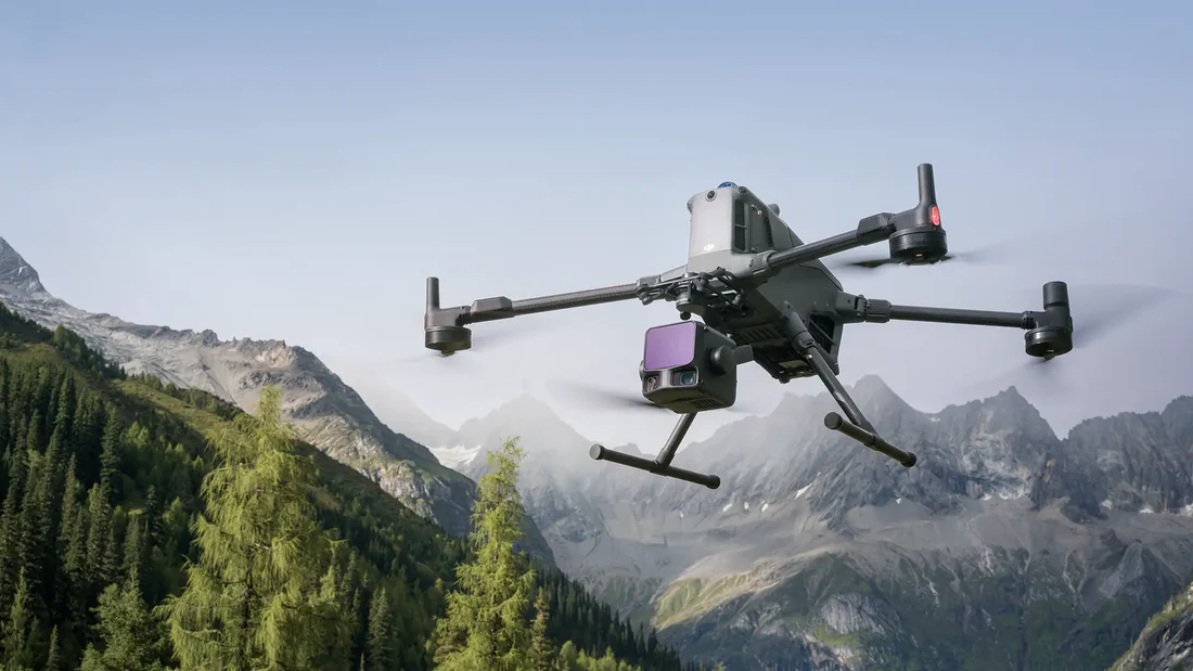
For Canadian aerial survey and mapping work, this is the platform we lead with. The Matrice 400 is DJI's current flagship, and the Zenmuse L3 is its latest LiDAR payload — built for longer range and higher point density than the previous-generation L2/L1 systems.
What it's good for
- Corridor mapping — transmission lines, pipelines, rail, roadways
- Stockpile and volumetric surveys for mining and aggregates
- Construction site capture and topographic mapping
- Forestry and terrain modeling under canopy
Why we recommend it
- Current flagship pairing — the newest hardware DJI has shipped in this class
- Integrates directly with DJI Terra and LiDAR360 for processing
- Exports to LAS/LAZ, DXF, and GeoTIFF, compatible with MineSight, Deswik, Vulcan, Surpac, and Leapfrog
- We're an authorized DJI Enterprise dealer — sales, training, and warranty support handled end to end
- Pairs with a Hextronics dock for sites that need recurring, scheduled capture rather than one-off flights
Prefer Not to Own the Hardware?
Our Remote Operations Center (ROC) program runs the workflow for you — mission planning, flight ops, compliance, processing, reporting — with zero hardware investment and one predictable monthly cost. Built for multi-site portfolios that want survey data delivered on a schedule without standing up an internal flight team.
Bottom Line
For most Canadian survey and mapping programs, the Matrice 400 + Zenmuse L3 is our standard recommendation — DJI's current flagship platform, fully supported by our sales, training, and warranty team. Talk to us about pairing it with a Hextronics dock if your site needs recurring coverage, or about ROC if you'd rather have us fly it for you.
Shop the story
Related products in our catalog
Every product below is stocked and supported by Remote Robotic in Canada.
- DJI Matrice 400
DJI Matrice 400
Flagship enterprise M400 airframe — 59 min flight, 6 kg payload, multi-sensor ready.
View product → - DJI Zenmuse L3
DJI Zenmuse L3
1535 nm long-range LiDAR + dual 100 MP RGB — survey-grade M400 mapping payload.
View product → - DJI Terra
DJI Terra
Desktop mission planning + LiDAR / photogrammetry post-processing suite.
View product →