
Managed Inspections
Remote Operations Center (ROC) for Inspection in Canada: Automated Drone Inspections Without Owning a Fleet
Remote Robotic installs automated drone docks, runs inspections remotely and delivers visual, thermal and mapping data to your teams without owning a fleet.
Remote Robotic · October 7, 2026 · 12 min read
Canadian infrastructure is spread across huge distances and exposed to some of the toughest weather in the world. Energy and utilities, mining, oil and gas, and construction sites all need regular inspection of their electrical equipment, structures and industrial facilities. Inspecting them the traditional way means sending crews out on the road, working at height, waiting for good weather and writing reports by hand.
Drones have made inspections faster and safer. But running your own drone program brings its own workload: aircraft, docks, licensed pilots, maintenance, scheduling, data processing and compliance records.
Remote Robotic's Remote Operations Center (ROC) takes all of that off your plate. We install automated drone docks at your sites and run every inspection remotely. We supply the drones, we fly them, and you get the data.
What is a Remote Operations Center?
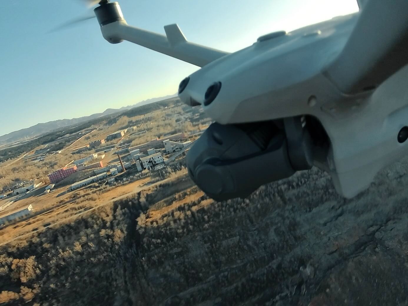
The ROC is a central command centre that runs drone inspections remotely. We install DJI Dock 3 units at or near your assets. Each dock houses a drone that launches, flies its inspection route, lands and recharges on its own.
Our Transport Canada–licensed RPAS pilots oversee every mission from the ROC. They watch the live video, monitor the aircraft and take manual control whenever an inspection needs a closer look. Your maintenance, engineering and asset management teams get inspection data on schedule, without sending anyone to site.
What the ROC inspects
Inspection applications for Remote Robotic's target industries: energy and utilities, mining, oil and gas, and construction.
01Electrical substations
- Thermal scans of transformers, breakers, bushings, switches and connections to find hot spots before they fail
- Zoom inspection of insulators, hardware and structures for cracks, corrosion and damage
- Gauge and indicator readings, captured from the same position every time
- Perimeter and security checks of fences, gates and yards
- Repeat imagery for comparisons over time and maintenance records
02Transmission and distribution lines
- Corridor patrols along line routes, imported from your GIS data
- Thermal checks of splices, clamps and connectors
- Zoom inspection of insulators, cross-arms, conductors and hardware
- Vegetation encroachment monitoring along the right-of-way
- Rapid damage checks after storms, ice events and wildfires
03Solar farms
- Thermal scans to find faulty cells, hot spots, failed strings and inverter problems
- RGB imagery to spot soiling, cracked panels, snow cover and vegetation
- Orthomosaics of the whole site for asset records
- Scheduled scans that track how panel performance changes over time
04Wind farms
- Zoom inspection of towers, nacelles and blades for visible damage, erosion and icing
- Thermal checks of substations, collector systems and electrical equipment on site
- Access road and site condition monitoring
05Construction and civil structures
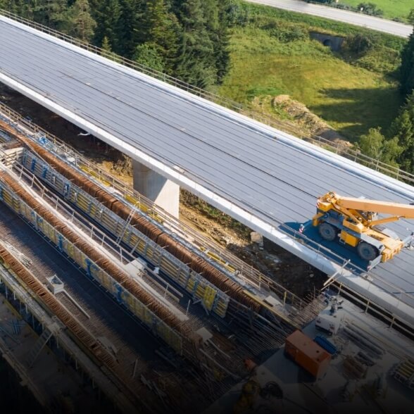
- Zoom inspection of decks, piers, bearings, joints and abutments
- Upward-tilting tele camera on the Matrice 4TD for undersides and soffits
- Cracking, spalling, corrosion and erosion documented with geotagged imagery
06Mining and oil & gas facilities
- Roof, stack, tank and structure inspections
- Thermal checks of motors, pumps, conveyors, electrical rooms and process equipment
- Pipe rack, flange and insulation inspections
- Leak, spill and steam plume detection
- Building envelope thermal surveys for heat loss and moisture
Automated inspections: your assets, photographed every day
Point-by-point inspection routes
We build waypoint routes around your critical assets, such as a transformer, an insulator string, a bridge bearing or a rooftop unit. At each point, the drone automatically:
- 1.Flies to the exact location and altitude
- 2.Points the camera at the component at a set angle and zoom
- 3.Takes RGB photos, thermal images, video or a panorama
- 4.Moves to the next point and returns to the dock when it's done
Same angle, every time
Accurate Photo recaptures each component from the same position, angle and zoom on every flight. That gives you true before-and-after comparisons. It's easy to see whether a hot spot is getting worse, a crack is growing or corrosion is spreading.
AI spot-checks
You mark an area of interest on a 3D model of your site, and the drone automatically captures and compares that exact area on every future flight. When something changes, it's flagged for review.
Daily image delivery
Photos, thermal images, video and models upload automatically to a secure media library after every flight. They're organized by site, asset, date and inspection point. Your teams can review them from a laptop, tablet or phone.
Flexible scheduling
| Schedule | Inspection cycle |
|---|---|
| Immediate | launch right now, on request. |
| Timed | run at a set time each day. |
| Recurring | daily, weekly, monthly or seasonal inspection cycles. |
| Continuous | back-to-back missions during outages, storms or critical work. |
| Alarm-triggered | launch automatically from a SCADA alarm, a security sensor or an AI alert. |
Inspection capabilities
RGB and zoom imaging
- Wide camera
- site overviews, orthomosaics and 3D models
- 70mm medium tele
- mid-range detail on equipment and structures
- 168mm tele
- close-up detail on bolts, insulators, welds, nameplates and gauges from a safe distance
- One-tap 360° panoramas
- a full view of a site in about a minute
- Electronic dehazing
- clearer images in haze and smoke
- Night Scene Mode
- usable colour images in low light
Thermal imaging (Matrice 4TD)
- Radiometric data
- temperature values in every pixel
- Temperature anomaly alerts
- automatic notifications when components run hotter than expected
- Thermal analysis
- detailed temperature reports for maintenance planning
- Night inspections
- thermal surveys when solar heating won't skew the readings
Measurement and location
- Laser rangefinder
- exact GPS location of a defect up to 1,800 m away
- On-map measurements
- distances and areas measured right on the map
- RTK positioning
- centimetre-level accuracy for repeatable flight paths and mapping
AI and analysis
- Change detection
- compares repeat flights and highlights new damage, missing components or site changes
- Object detection
- flags people and vehicles near critical assets
- Defect tagging
- links each finding to its location on a map or 3D model
- Automated reports
- inspection findings delivered without manual write-ups
- Automated workflows
- chains steps together, for example scheduled inspection, then data capture, then AI analysis, then notification to your team
Live remote inspection
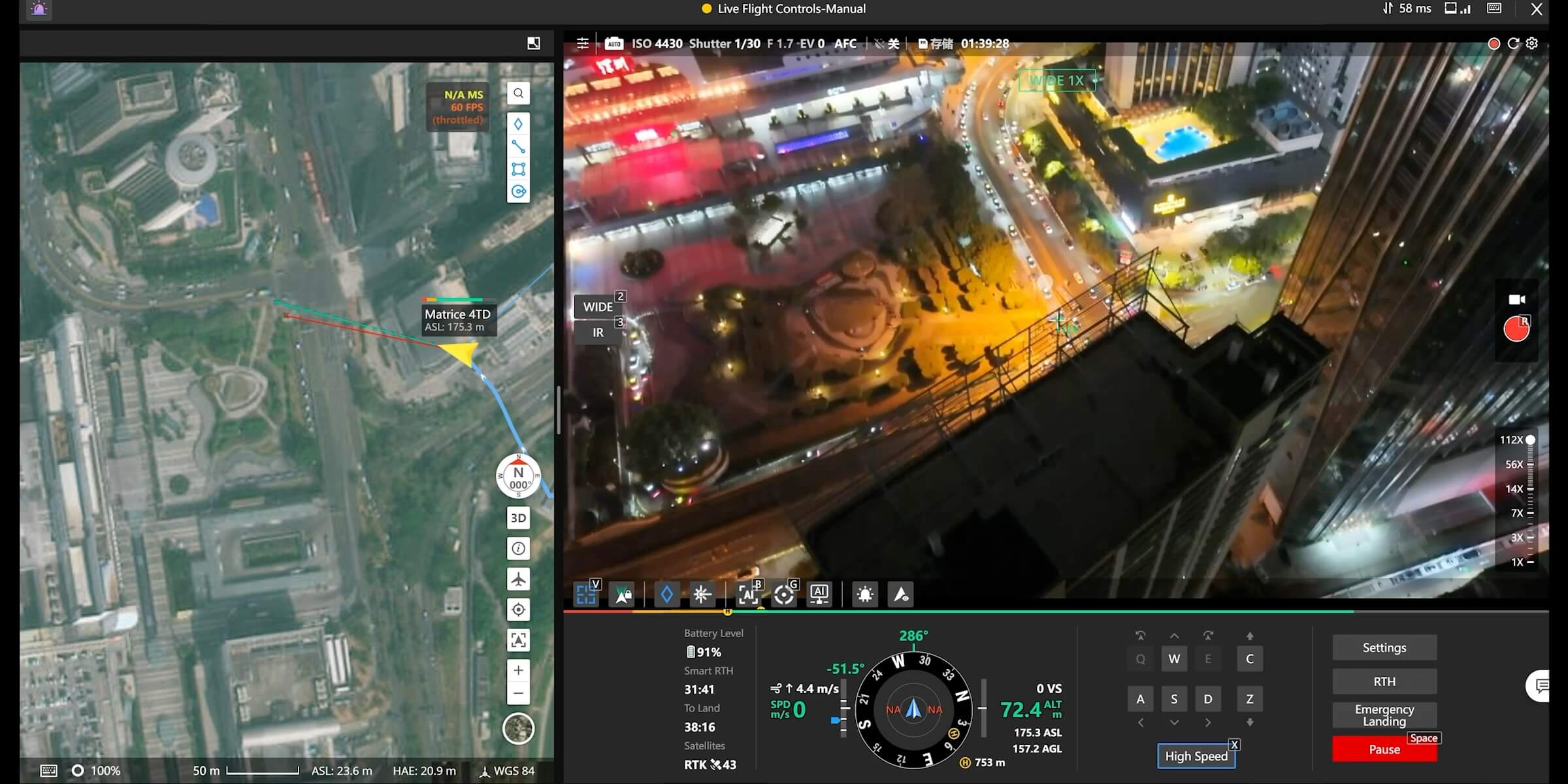
When something needs a closer look, the ROC can inspect it live.
| Live inspection | Capability |
|---|---|
| Live streaming | HD video from the drone and the dock, shared with your engineers through a secure link |
| Remote camera control | our pilots redirect the camera and zoom in real time to follow your team's directions |
| Live annotations | pins, lines and areas drawn on a shared map, so field crews know exactly where to go |
| Rapid response | a drone over the asset within minutes of an alarm or outage |
The platform: DJI Dock 3 with Matrice 4D and 4TD
DJI Dock 3
| Dock capability | Specification |
|---|---|
| Built for Canadian conditions | IP56 rated, runs from –30°C to 50°C, and heats and cools itself automatically. |
| Weather-aware | Built-in wind, rain and temperature sensors hold flights automatically when conditions aren't safe. |
| Fast response | The drone can be airborne in about 10 seconds after a mission is triggered. |
| Fast turnaround | The drone recharges from 15% to 95% in about 27 minutes. |
| Wide coverage | Each dock covers a radius of up to 10 km. |
| Resilient | A backup battery keeps the dock running for more than 4 hours if site power fails. |
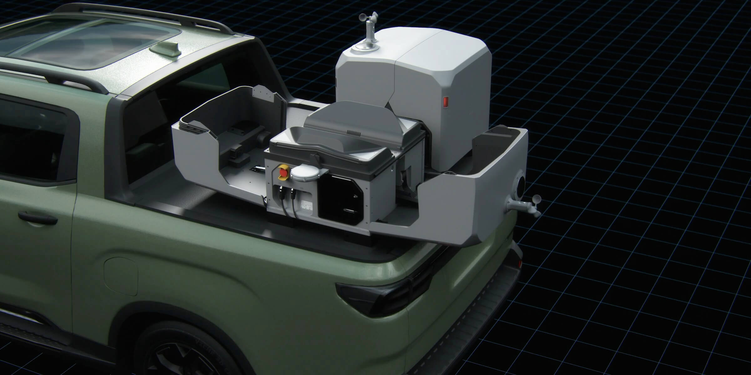
| Fixed or mobile | Install it permanently on a pad or rooftop, or mount it on a vehicle for temporary or mobile inspection work. |
| Flexible connectivity | Connects over Ethernet or 4G. |
Matrice 4D: visual inspection and mapping
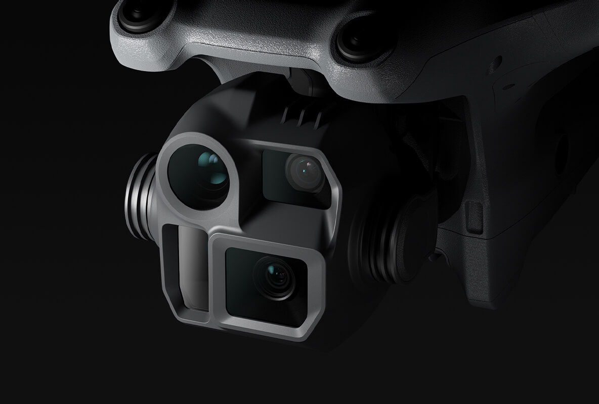
- 20MP 4/3" wide camera with a mechanical shutter for survey-grade mapping and 3D models
- 70mm medium tele and 168mm tele cameras for close-up detail from a safe distance
- Laser rangefinder that measures up to 1,800 m
Matrice 4TD: thermal inspection and night operations
- 640×512 radiometric thermal camera that measures temperatures from –40°C to 500°C
- Infrared super-resolution up to 1280×1024
- 48MP wide, medium tele and tele cameras
- Tele camera that tilts upward up to 80° for inspecting the underside of structures
- NIR auxiliary light and Night Scene Mode for low-light inspections
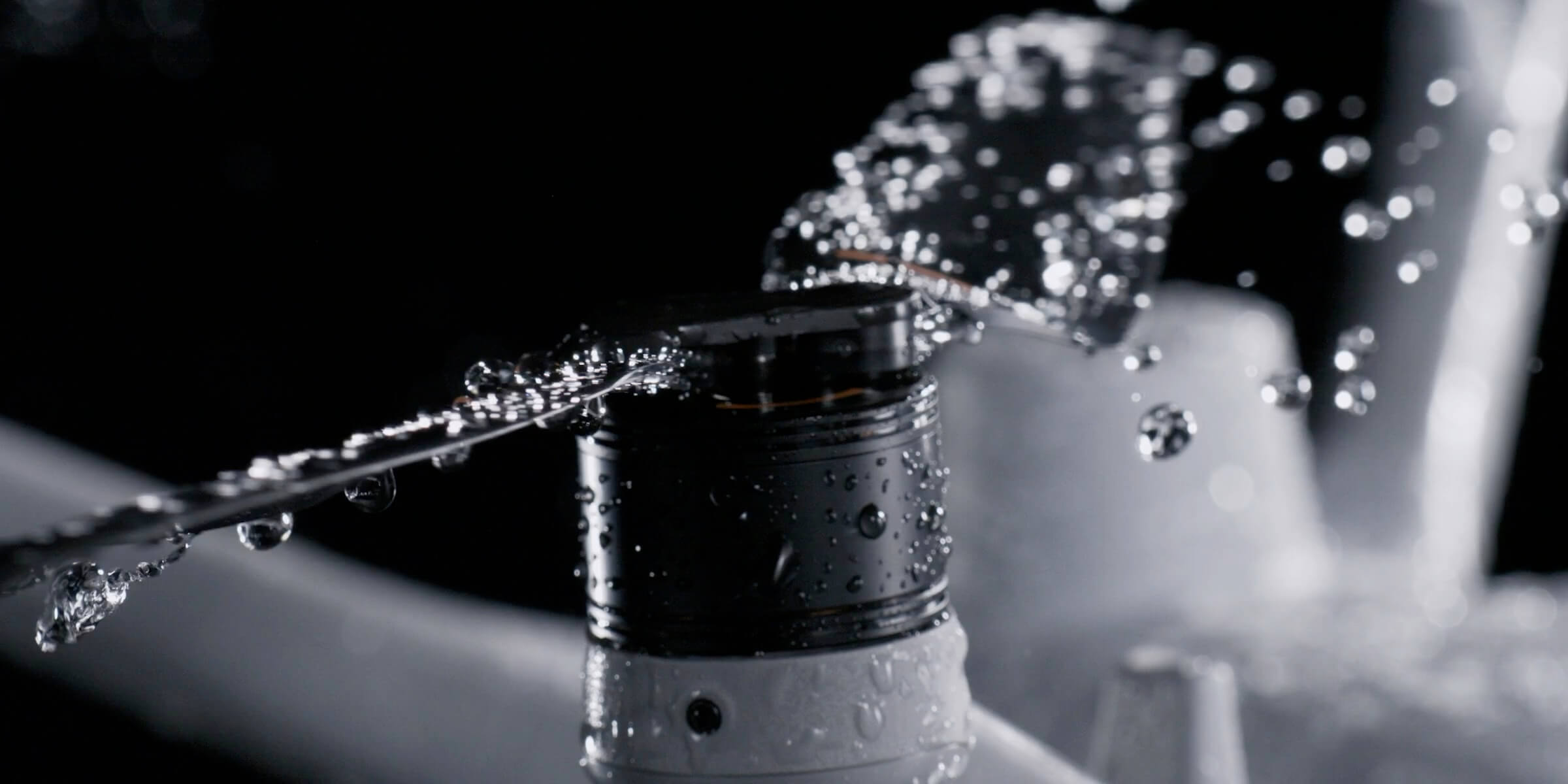
Both aircraft fly for up to 54 minutes, are IP55 rated, use anti-ice propellers, and use rotating LiDAR and millimetre-wave radar for 360° obstacle sensing, day and night.
Safety and control built in
| Control | Capability |
|---|---|
| Custom geofences | keep the drone at safe distances from energized equipment and restricted areas |
| Automatic weather holds | no launches in unsafe wind, rain or cold |
| 360° obstacle sensing | rotating LiDAR and radar, effective day and night |
| Secure data | encrypted transmission and an ISO 27001 and ISO 27701 certified platform |
Inspection deliverables
- Geotagged RGB and zoom inspection photos, organized by asset and inspection point
- Radiometric thermal images and temperature reports
- Orthomosaics and 3D models
- Before-and-after comparisons
- AI change and anomaly detection reports
- Live and recorded video
- Flight documentation and chain-of-custody records
What's included
| Included | Remote Robotic responsibility |
|---|---|
| Hardware | we own and maintain the Dock 3 units, aircraft and accessories. |
| Pilots | Transport Canada–licensed RPAS pilots oversee every mission from the ROC. |
| 24/7 monitoring | with automatic weather holds. |
| Inspection planning | routes built around your assets and inspection requirements. |
| Processed data | inspection imagery, thermal reports, maps and 3D models. |
| AI reporting | change and anomaly detection, with automatic notifications. |
| Compliance | flight documentation and chain-of-custody records for every mission. |
| Hardware support | OEM-tier support keeps the fleet flying. |
Why teams choose the ROC for inspections
- No capital outlay
- you don't buy docks, aircraft or batteries.
- No pilot hiring or training
- licensed pilots are included.
- Safer work
- fewer climbs, less work near energized equipment and fewer road trips.
- More frequent inspections
- daily or weekly instead of once or twice a year.
- Earlier detection
- catch hot spots, damage and changes before they become failures.
- Consistent data
- the same flight path, angles and settings every time.
- Faster response
- a drone over the asset within minutes of an alarm.
- Year-round operation
- built for Canadian winters.
- Scales with you
- start with one site, then expand across your network.
Start small, scale up
Most clients start with one high-value site, such as a substation, a solar farm or an industrial facility. Once they've seen the data, they add more inspection routes and more docks. The ROC grows with your asset base, using the same procedures, standards and reporting at every site.
Coverage across Canada
Remote Robotic has service points in Mississauga (HQ), Ottawa, Calgary, Burnaby and Montréal. We operate 24/7/365, and our service levels range from best-effort to guaranteed dispatch, so you can match coverage to how critical each asset is.
Frequently asked questions
Do we need staff on site?
No. You only need a power supply and a network connection at the dock. Our pilots run every inspection from the ROC.
Can the drone inspect energized equipment?
Yes. Inspections are done from a safe distance using zoom and thermal cameras, and geofences keep the drone clear of energized equipment.
How often can inspections run?
As often as you need, whether that's several times a day, daily, weekly or monthly. The drone needs about 27 minutes to recharge between flights.
Can it fly in winter?
Yes. Dock 3 runs down to –30°C and heats itself automatically, and the drones use anti-ice propellers. Flights hold automatically in high wind, heavy precipitation or extreme cold.
How far can one dock cover?
Up to 10 km in each direction, depending on wind, temperature and mission type. Larger networks use several docks.
What do we receive after each inspection?
Geotagged photos, thermal images, video, maps, 3D models and AI reports, delivered to a secure media library your team can access from any device.
Get started
Book a ROC briefing with our operations team and we'll build an inspection program around your assets, your schedule and the data you need.
Shop the story
Related products in our catalog
Every product below is stocked and supported by Remote Robotic in Canada.