
ROC – Remote Operation Center
AI Detection with the DJI Matrice 5TD and FlightHub 2: What It Means for Your Industry
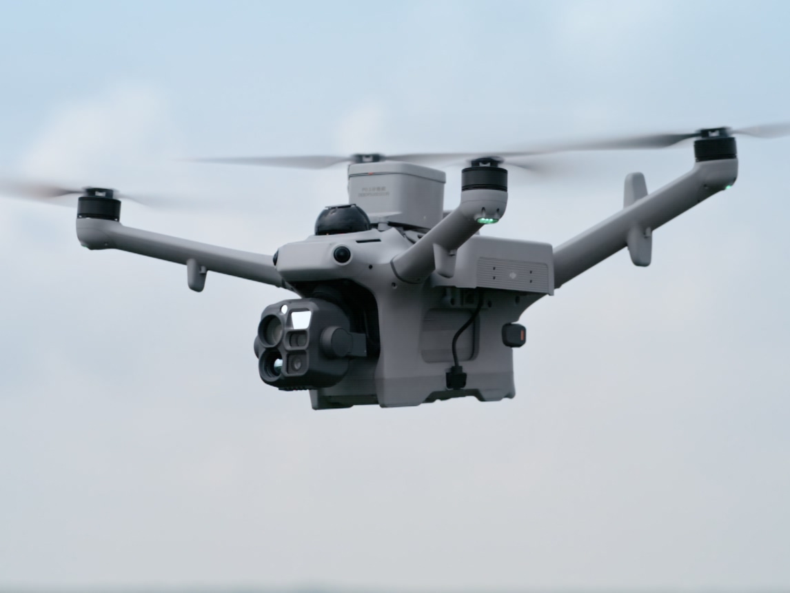
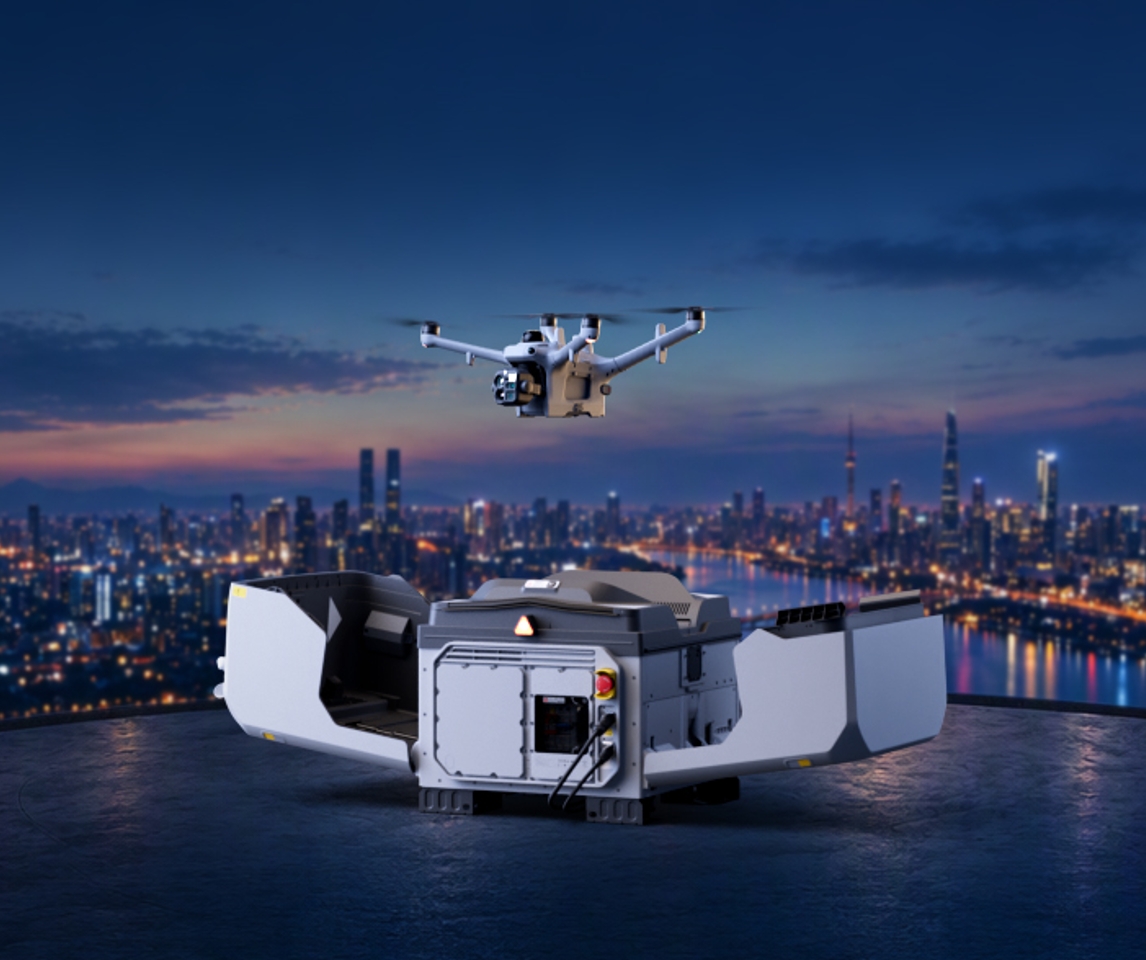
The DJI Matrice 5TD flies automatically from DJI Dock 4 with onboard AI object detection, thermal and zoom cameras. Run through FlightHub 2 and Remote Robotic's ROC, every patrol, inspection and response becomes actionable information.
Remote Robotic · October 26, 2026 · 8 min read
A drone that only records video still needs someone to watch it. On a large site, or across many sites, that doesn’t scale. The real value of an automated drone is knowing what’s happening in the picture, without a person checking every frame.
The DJI Matrice 5TD, which flies automatically from DJI Dock 4, combines wide-angle, zoom and infrared cameras with onboard AI. Through DJI FlightHub 2, it can recognize people, vehicles and boats in both visible and infrared imagery, flag abnormal temperatures, track targets and send alerts automatically. Combined with Remote Robotic’s Remote Operations Center (ROC), it turns every patrol, inspection and response into actionable information instead of hours of footage.
This guide explains what the Matrice 5TD brings to public safety, private security, mining, energy, oil and gas, and construction.
What the Matrice 5TD brings to the job
| Capability | What it does |
|---|---|
| Visible-light AI detection | Recognizes people, vehicles and boats in real time |
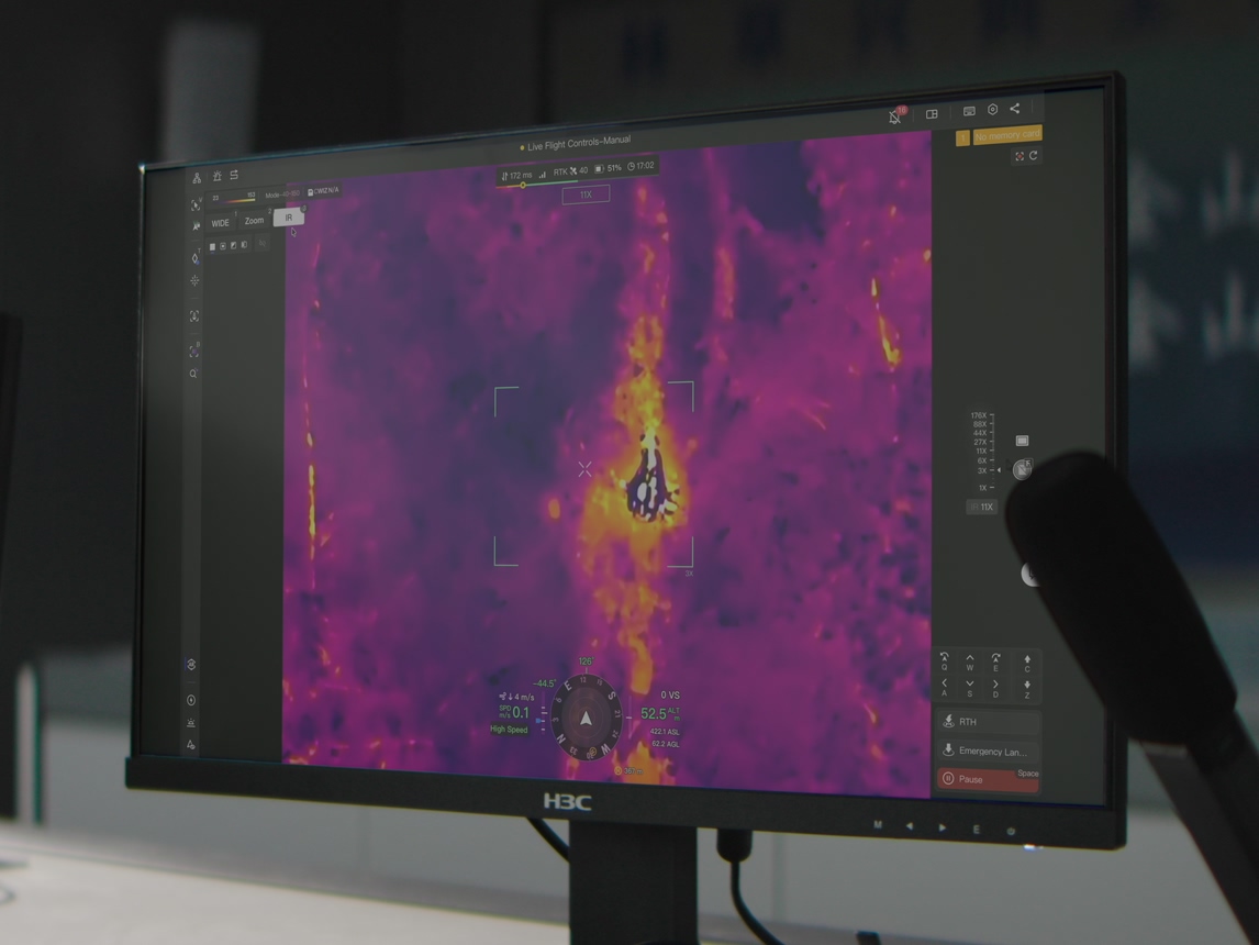
| Infrared AI detection | Recognizes people, vehicles, vessels and moving objects in thermal imagery |
| Infrared temperature alerts | Flags areas outside a set temperature range |
| Text and image search | Finds targets you describe in text or show in a photo |
| Smart Track | Locks onto and follows a detected target |
| Thermal camera | 1280×1024 resolution, ultra-high-resolution mode up to 2560×2048, sensitivity ≤50 mK |
| Temperature measurement | –40°C to 150°C (high gain), 0°C to 550°C (low gain), with spot and area measurement and temperature alerts |
| Visible and thermal fusion | Combines visible and thermal images in one view |
| Wide camera | 1/0.98" sensor, 50 MP |
| Tele camera | 252 mm equivalent, 16× digital zoom, up to 176× hybrid zoom |
| Night Scene Mode | ISO up to 1,638,400 |
| Laser rangefinder | Up to 3,000 m |
| Flight time | Up to 59 minutes |
| Speed | Up to 21 m/s on FlyTo missions |
| Operating temperature | –40°C to 50°C |
| AS2D speaker | 120.5 dB, 400 m broadcast range |
| AL2D light | 40 W spotlight and 18 W floodlight |
| Dock 4 battery swap | Under 25 seconds, with landing-to-takeoff in under 45 seconds |
What the AI detects
Visible-light detection
- People
- Vehicles
- Boats
Infrared detection
- People
- Vehicles
- Vessels
- Moving objects
Infrared temperature
- Areas above or below a set temperature, from –20°C to 550°C
Custom search
- Describe a target in text, for example “small black sedan”
- Upload a photo of the target
- Draw a box around something in the live feed
Each target type has its own alert threshold. For example, an alert can trigger when one person is detected, or when more than five vehicles are detected.
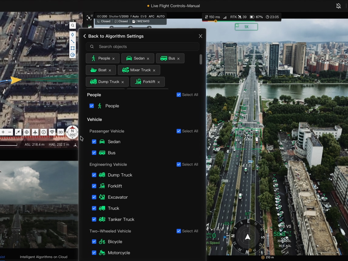
Coming soon for Dock 4: DJI has announced more recognition targets, including smoke and fire and animals.
At a glance: where AI monitoring fits
| Industry | Typical missions | Key Matrice 5TD tools |
|---|---|---|
| Policing and DFR | Dock as First Responder, live video, collision reconstruction | AI detection, Smart Track, thermal, Night Scene Mode, 3 km laser rangefinder |
| Fire and rescue | Fire size-up, wildfire spread, search and rescue, water rescue, disaster response | Radiometric thermal up to 550°C, infrared AI detection, temperature alerts |
| Private security | Alarm response, night patrols, multi-site coverage | AI patrol routes, AS2D speaker, AL2D light |
| Mining and surveying | Hazard zones, haul roads, stockpiles, tailings | Thermal hot spots, FlightHub 2 change detection |
| Energy and utilities | Substations, right-of-way, hydro and waterways, storm response | 1280×1024 radiometric thermal, 252 mm tele camera |
| Oil and gas | Pipeline right-of-way, flares, well pads | Radiometric thermal, E-Port V3 gas sensors (up to 450 g) |
| Construction | Progress, site activity, after-hours security | AI change detection between flights |
Public safety
Policing and Drone as First Responder (DFR)
When a call comes in, the drone takes off as soon as the dock opens and flies to the scene at up to 21 m/s. It’s airborne and on scene ahead of ground crews, streaming live video.
- Dock as First Responder: automatic launch from a dock to the incident location.
- Situational awareness: officers see the scene before they arrive.
- AI detection: recognizes people and vehicles in the live feed, day or night, and Smart Track follows them automatically.
- Custom search: describe a suspect vehicle in text, such as ‘white cargo van’, and the AI searches for it.
- Night operations: thermal imaging and Night Scene Mode support work in darkness.
- Collision reconstruction: document the scene and vehicle positions from above.
- Precise locations: the 3 km laser rangefinder measures the distance and position of targets.
Fire and rescue
- Urban fires: live aerial and thermal video for size-up and tactics.
- Wildfires: monitor fire behaviour and spread from the air.
- Hot spots: radiometric thermal imaging measures temperatures up to 550°C and finds heat that can’t be seen with the naked eye.
- Search and rescue: thermal and zoom cameras help locate people, day or night.
- Infrared AI detection: recognizes people in thermal imagery during search and rescue.
- Water rescue: boat detection supports searches on lakes and rivers.
- Disaster response: rapid aerial assessment after floods, storms and other emergencies.
- Temperature alerts: flag areas above set thresholds.
Private security
- Alarm response: the drone launches automatically when a fence, camera or sensor alarm goes off.
- AI patrol routes: automatically detect people and vehicles in restricted areas and send alerts with snapshots and locations.
- Automatic response: when a person is detected, the drone can take photos, record video, broadcast a warning and turn on the spotlight.
- Night patrols: thermal imaging and Night Scene Mode for 24/7 coverage.
- Deterrence: the AS2D speaker broadcasts warnings up to 400 m, and the AL2D light lights up the scene.
- Continuous coverage: Dock 4’s battery swap keeps the drone ready for back-to-back patrols.
- Multi-site coverage: one operations centre patrols many facilities.
Industrial
Mining and surveying
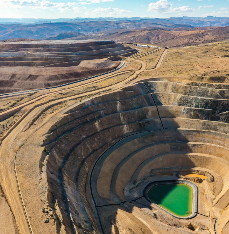
- Hazard zone checks: monitor blast areas, pit edges, stockpiles and tailings facilities without sending people in.
- Equipment and haul road monitoring: see activity across the site from above.
- Hot spot detection: thermal imaging and temperature alerts help find heating in stockpiles and overheating equipment.
- Site security: AI patrol routes detect people and vehicles at remote mine sites and in restricted zones.
- Change detection: FlightHub 2’s AI tools compare repeat flights to highlight changes such as stockpile movement and site modifications.
Energy and utilities
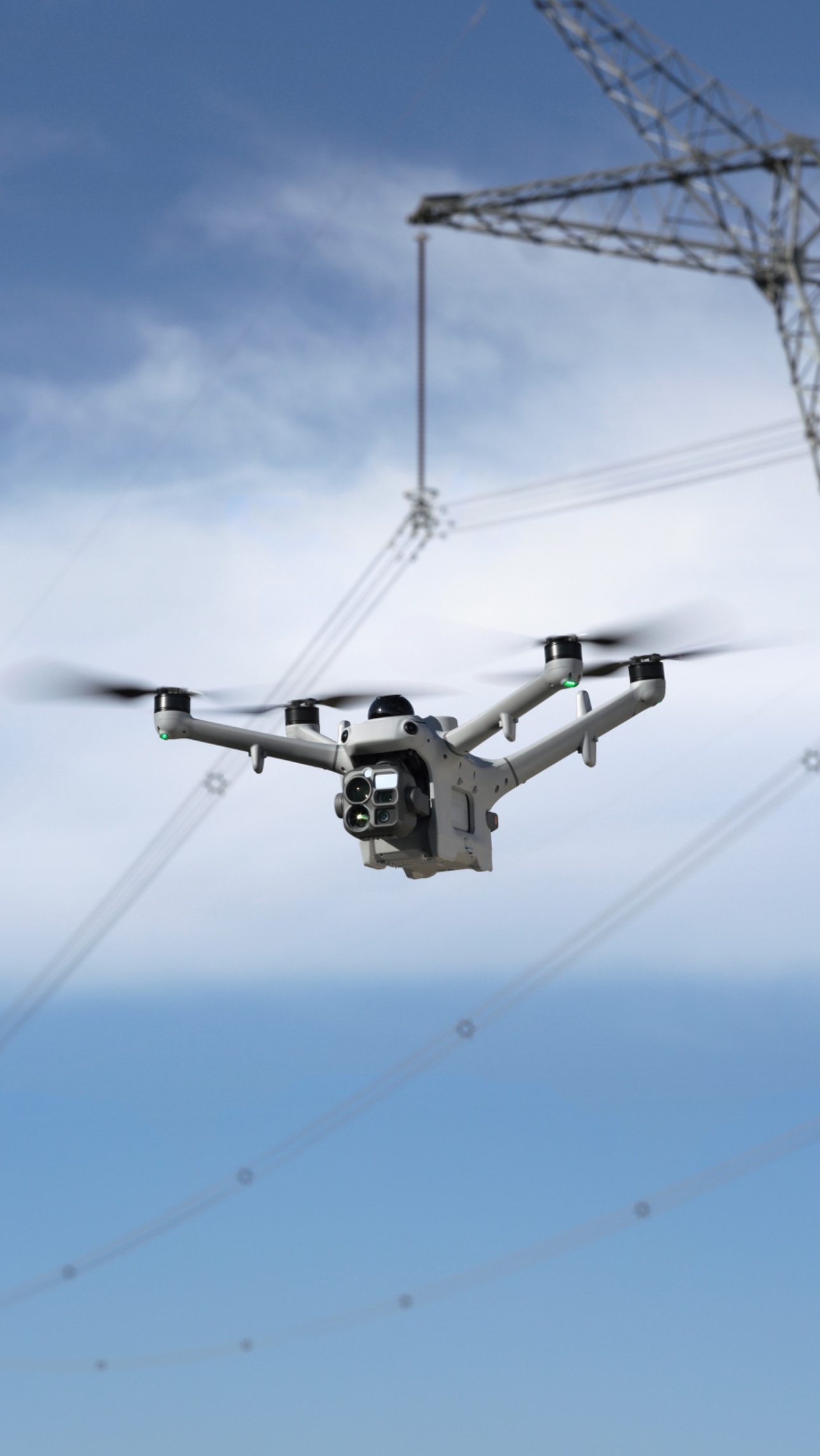
- Substation thermal inspection: 1280×1024 radiometric thermal for spotting hot connections and components.
- Right-of-way monitoring: patrol transmission corridors for activity and encroachment.
- Substation security: AI detects people and vehicles inside fences and restricted areas, with automatic alerts.
- Hydro and waterways: boat detection on reservoirs and near dams.
- Wildfire watch: monitor assets and corridors during fire season.
- Storm response: rapid damage assessment after severe weather.
- Close-up inspection: the 252 mm tele camera inspects components from a safe distance.
Oil and gas
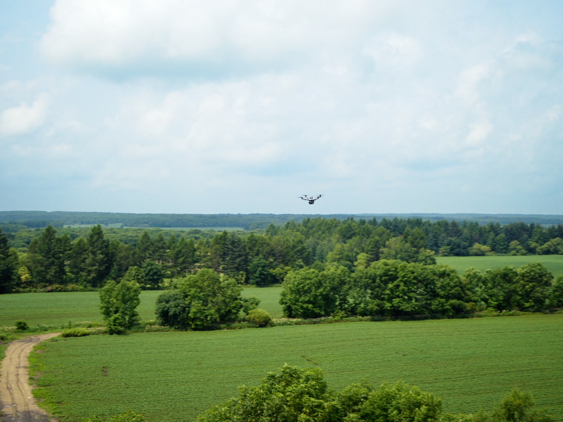
- Pipeline right-of-way patrols: watch for activity and ground disturbance near buried pipelines.
- Flare monitoring: thermal imaging confirms flares are lit and burning.
- Equipment inspection: spot hot equipment and abnormal temperatures with radiometric thermal.
- Site security: AI detects people and vehicles at remote well pads and facilities, day or night.
- Infrared temperature alerts: flag hot equipment and abnormal temperatures automatically.
- Emergency response: live aerial and thermal video during fires and releases.
- Gas detection: compatible gas sensors can be mounted on the drone’s E-Port V3 ports (up to 450 g).
Construction
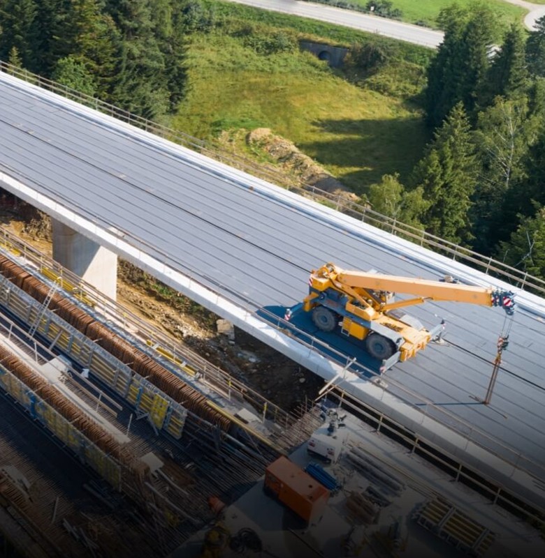
- Progress monitoring: automated capture from the same viewpoints, with AI change detection between flights.
- Site activity: see equipment and logistics across the site from above.
- After-hours security: AI patrol routes detect people and vehicles on site once work has stopped.
- Safety: monitor restricted and hazardous areas without sending people in.
What happens when the AI detects something
When an alert threshold is met during an automated mission, the drone can automatically:
- Take photos of each detected object
- Record video for a set length of time
- Hover and wait for a pilot to take over
- Turn on the speaker to broadcast a warning
- Turn on the spotlight to light up the scene
- Send a warning message with a snapshot and location to selected users
At the ROC, detections are highlighted on screen with an alert sound and pop-up notification. Our pilots can use Smart Track to lock onto and follow a target, and the system tries to re-acquire it automatically if it’s lost.
AI patrol routes
You draw the area you want covered on a map, and FlightHub 2 automatically plans a patrol route over it.
- People alerts are on by default.
- Vehicle and boat alerts can be added.
- Recognition can be limited to specific zones, such as a fence line, a laydown yard or a pipeline corridor.
- Altitude and camera angle are set for each target type to give the best recognition rates.
That makes it easy to set up security patrols, perimeter checks and corridor monitoring that run automatically on a schedule.
From detection to action
- 1
The drone flies its mission: a scheduled patrol, a routine inspection or an emergency response.
- 2
AI scans in real time: people, vehicles, boats and abnormal temperatures are recognized during the flight.
- 3
Findings are located: the laser rangefinder measures distance and position.
- 4
Your team is notified: warning messages with snapshots and locations are sent to selected users.
- 5
Pilots investigate: licensed ROC pilots can zoom in, switch to thermal and stay overhead.
- 6
Live video is shared: officers, responders, security teams and site managers see what the drone sees.
- 7
Everything is recorded: imagery and flight logs are saved for reports and investigations.
AI change detection
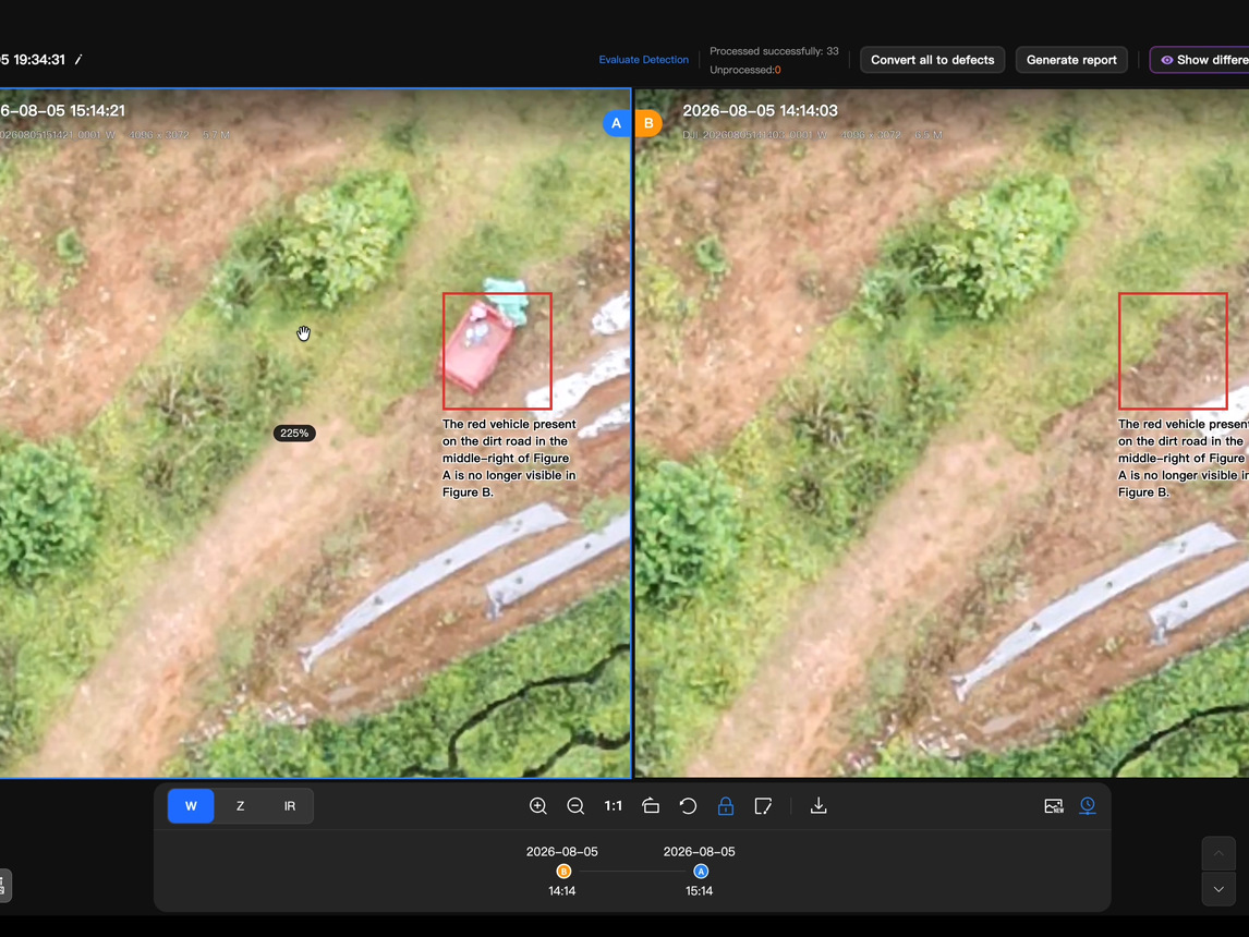
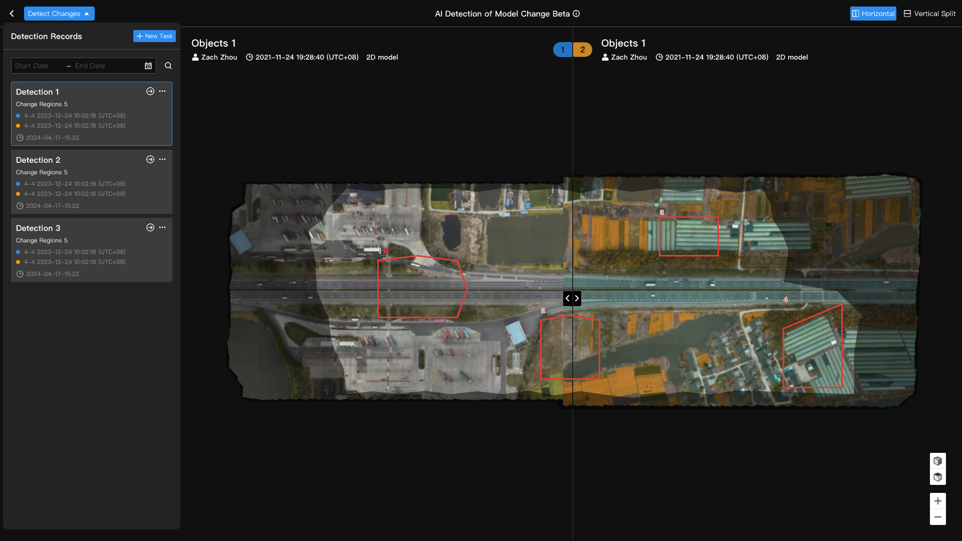
FlightHub 2 compares photos taken from the same inspection points on two different missions and automatically marks what’s changed.
- Ignore vehicles: parked or moving vehicles aren’t flagged as changes.
- Set a minimum change size: filter out small, unimportant differences.
- Edit results: add, remove or adjust the marked changes.
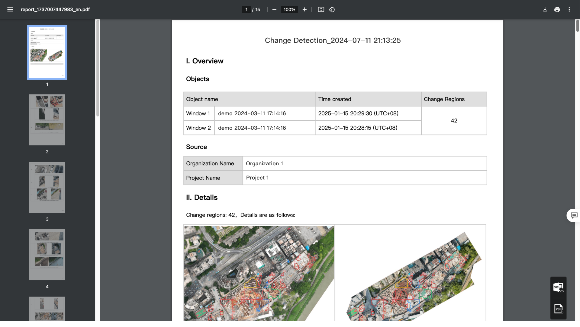
- Export reports: as PDF or Word, with change statistics, photos and coordinates.
- Change Detection Pro: detects changes even when photos aren’t taken from exactly the same angle, and can produce AI-generated reports.
Instead of reviewing thousands of images, your team reviews only what’s different.
Records and reporting
- AI Warning Records: every alert is logged with a snapshot, and can be filtered by date, category and object type.
- Route warnings: each one shows the trigger time, conditions, object location and snapshot.
- Exportable reports: of AI warning events from flight records.
- Smart Search: automatically tags and counts objects in stored photos and videos.
- AI reports: generate reports with charts and insights from a plain-language request.
Why AI matters
01
Real-time results
Objects of interest are flagged during the flight.
02
Less footage to review
Your team focuses on what matters.
03
Faster response
Teams act while the situation is still unfolding.
04
Consistent attention
AI doesn’t get tired on the 100th patrol.
05
Day and night
AI works alongside thermal and low-light imaging.
06
Scales across sites
The same workflow runs on every mission, everywhere.
AI with human oversight
AI makes monitoring faster and more consistent, but people stay in control:
- Licensed pilots oversee every mission.
- AI findings are reviewed before anyone takes action.
- Pilots can take manual control to investigate.
- Your team decides how to respond.
AI flags it, our pilots confirm it, and your team acts on it.
Frequently asked questions
What is the Matrice 5TD?
DJI’s thermal drone for DJI Dock 4. It has wide-angle and infrared cameras, mmWave radar, LiDAR and onboard AI object detection.
What can the Matrice 5TD’s AI detect?
Through FlightHub 2, it recognizes people, vehicles and boats in visible imagery, and people, vehicles, vessels and moving objects in infrared imagery. It can also flag abnormal temperatures. DJI has announced smoke, fire and animal detection as coming soon for Dock 4.
Can the AI search for something specific?
Yes. You can describe a target in text, upload a photo, or draw a box around it in the live feed.
What happens when the AI detects something?
The drone can automatically take photos, record video, hover for a pilot to take over, or turn on the speaker and spotlight. A warning with a snapshot and location is sent to your team.
Can the drone follow a target?
Yes. Smart Track locks onto a detected target and follows it.
Does the AI work at night?
Yes. Infrared AI detection recognizes people, vehicles and moving objects in thermal imagery, and Night Scene Mode supports low-light colour imaging.
How fast can the drone reach a scene?
It takes off as soon as the dock opens and flies at up to 21 m/s on FlyTo missions, streaming live video.
How quickly can it fly again?
Dock 4 swaps the battery in under 25 seconds, with landing-to-takeoff in under 45 seconds.
Will AI replace officers, guards or inspectors?
No. AI handles the repetitive watching and flags what matters, so your team can focus on responding and making decisions.
Does it work in Canadian winters?
Yes. Dock 4 and the Matrice 5TD operate from –40°C to 50°C.
Do we need anyone on site?
No. You only need power and a network connection at the dock.
Get started
Turn every patrol, inspection and response into actionable information. Book a ROC briefing and we’ll design an AI-powered program around your industry, your sites and your team.
Request a briefing with the ROC form below or call 416-303-3575.
ROC program
Talk to the ROC team
Shop the story
Related products in our catalog
Every product below is stocked and supported by Remote Robotic in Canada.
- DJI Matrice 5TD
DJI Matrice 5TD
Dock 4 aircraft with wide + 1280×1024 thermal cameras, mmWave radar and LiDAR — 59 min flight, 3,000 m laser rangefinder.
View product → - DJI Dock 4
DJI Dock 4
DJI's first battery-swapping dock — ~25-second swaps for 24/7 operations, −40°C to 50°C, IP56. Pairs with the Matrice 5TD.
View product →