

Industrial Brief
DJI Matrice 4E for Mining & Surveying: Stockpile Volumetrics, Pit Progression & Slope Monitoring
The DJI Matrice 4E for mine surveying — RTK photogrammetry for stockpile volumetrics, pit and bench progression, and slope monitoring. 49-min flight, 4/3-inch mapping camera, 1 cm RTK. Verified specs and Canadian mining use cases.
Remote Robotic · July 19, 2026 · 7 min read
Last verified against DJI's published Matrice 4 Series specifications: July 2026.
Why the Matrice 4E Fits Mine Surveying
Mine survey data has to reconcile — stockpile volumes against production, pit progression against the plan, slope movement against last month. That means centimetre-accurate, repeatable capture on a schedule, not a one-off flight. And on a working site at elevation, in Canadian weather, the aircraft has to deploy fast and fly enough of the pit to be worth the trip out.
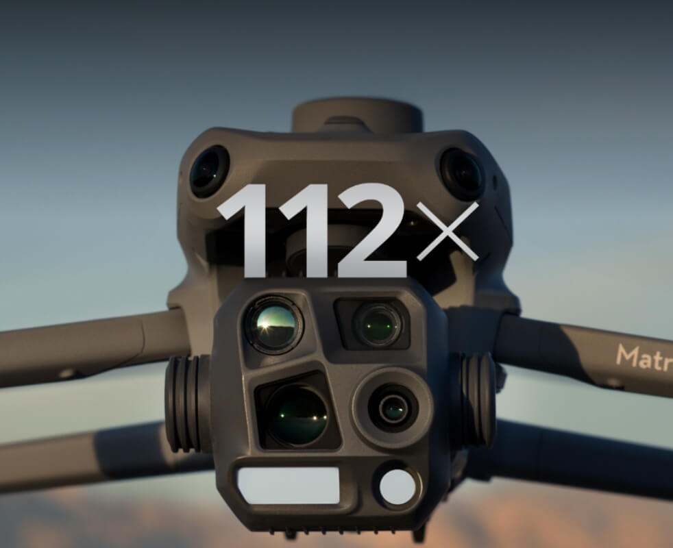
The Matrice 4E was built for that, and DJI markets it specifically for surveying, mapping, and mining. Its distinguishing feature is a 4/3-inch 20 MP wide camera with a mechanical shutter — the sensor and shutter combination that produces distortion-free imagery for accurate photogrammetric reconstruction, which the thermal-focused Matrice 4T doesn't carry. Pair that with RTK positioning (1 cm + 1 ppm horizontal, 1.5 cm + 1 ppm vertical) and the aircraft produces the survey-grade orthomosaics, DSMs, and point clouds that feed reconciliation — and it folds into a case and launches in minutes for a repeatable weekly capture.
The Operational Advantage
| Mining / survey job | What the Matrice 4E brings | On the aircraft / catalog |
|---|---|---|
| Stockpile volumetrics | Repeatable cm-grade volumes from RTK photogrammetry | 4/3-inch mapping camera |
| Pit & bench progression | Weekly captures feeding mine planning and reconciliation | Mechanical shutter |
| Slope & high-wall photogrammetry | Point-cloud change detection across faces and dams | RTK module, 112x zoom |
| Survey-grade deliverables | Orthos, DSMs, DTMs in your GIS coordinate system | DJI Terra / LiDAR360 workflow |
| RTK positioning without network coverage | Centimetre reference on remote pits | DJI D-RTK 3 Multifunctional Station |
| Underground & confined-space SLAM | Ground-robot scanning where GPS doesn't reach | Boston Dynamics Spot |
DJI Matrice 4E Key Specifications for Mining Work
| Specification | DJI's published figure (Matrice 4E) |
|---|---|
| Takeoff weight | 1,219 g (standard propellers) |
| Max takeoff weight | 1,420 g |
| Max payload | 200 g |
| Max flight time (no wind) | 49 min |
| Max hover time (no wind) | 42 min |
| Max horizontal speed | 21 m/s |
| Max wind speed resistance | 12 m/s (takeoff and landing) |
| Operating temperature | -10°C to 40°C |
| Max altitude | 6,000 m (4,000 m with payload) |
| RTK positioning accuracy | 1 cm + 1 ppm (H), 1.5 cm + 1 ppm (V) |
| Hovering accuracy (RTK) | ±0.1 m |
| Wide (mapping) camera | 4/3-inch CMOS, 20 MP, mechanical shutter |
| Medium tele / tele cameras | 48 MP each; 112x hybrid zoom |
| Min. photo interval | 0.5 s |
| Sensing | Omnidirectional binocular vision + downward 3D infrared |
| Video transmission | O4 Enterprise; 25 km FCC / 12 km CE |
| Battery | 99.5 Wh, 200-cycle rating |
Per DJI's footnotes, flight-time figures were measured in windless conditions without payload and are reference data — real-world numbers vary with wind, altitude, accessories, and firmware. Note the -10°C operating floor and the battery's lack of low-temperature charging support, which matter for Canadian winter work (see the cold-weather note below).
What Can the Matrice 4E Do on a Mine Site?
Six jobs cover most of what the 4E does well on a Canadian mine, quarry, or aggregate operation. Each maps to a specific, verified capability.
1. Stockpile Volumetrics
Stockpile counts have to reconcile against production, not just look about right. The 4E's 4/3-inch mapping camera and mechanical shutter produce distortion-free imagery for photogrammetric reconstruction, and RTK positioning (1 cm + 1 ppm) ties every volume to your site datum — so month-end stockpile volumes stand up against the pay estimate without a dense ground-control field.
Why it matters: repeatable, cm-grade stockpile volumes that reconcile against production.
2. Pit & Bench Progression
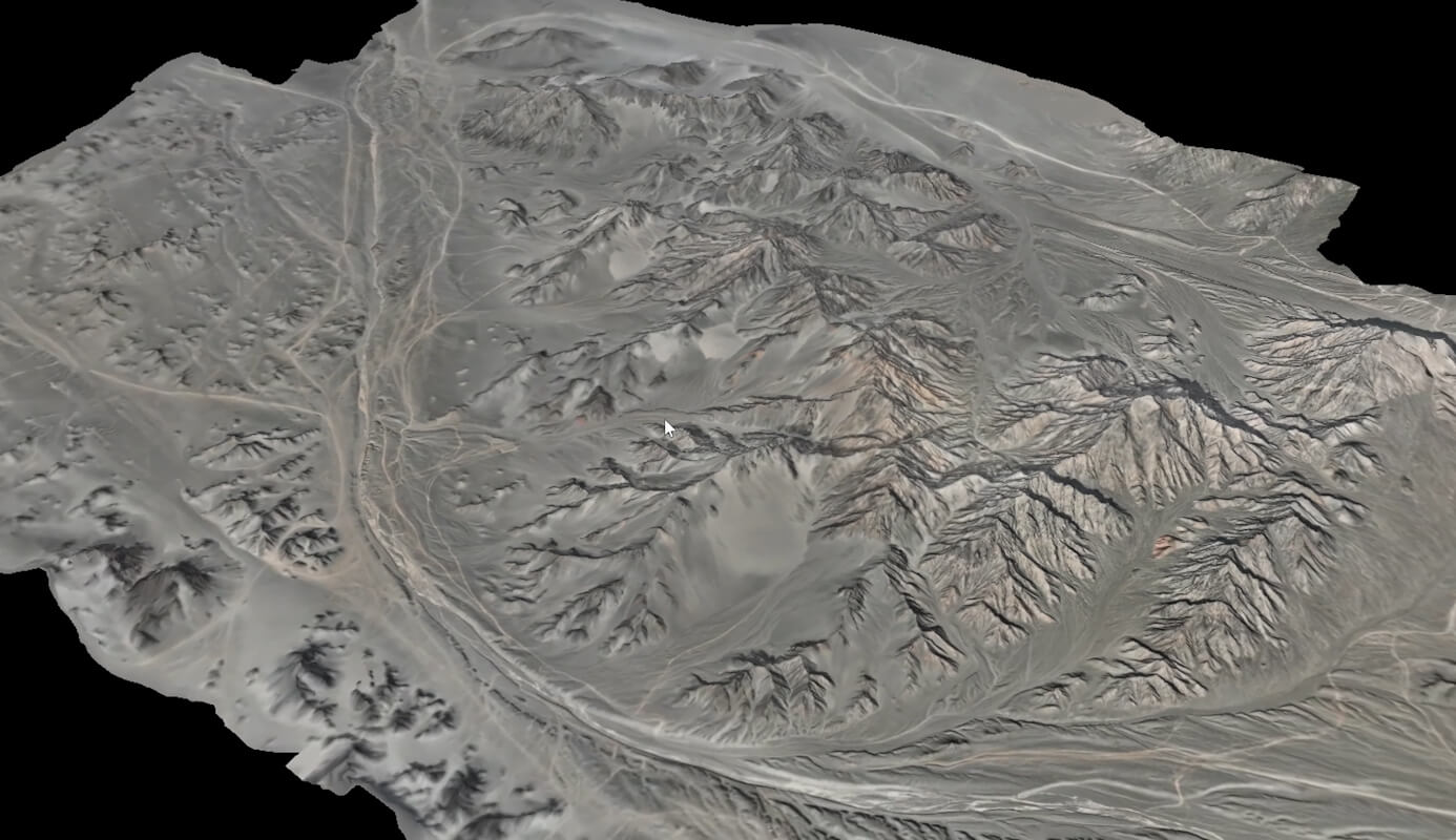
Mine planning and reserve tracking need a current, measurable model of the pit. A repeatable weekly 4E capture produces orthomosaics and surface models that feed progression tracking, reconciliation, and reserve updates — flown the same way each week so the datasets are comparable over time. A 49-minute flight covers a working pit in a single mission.
Why it matters: weekly pit models that feed planning and reconciliation, captured consistently enough to compare.
3. Slope & High-Wall Photogrammetry
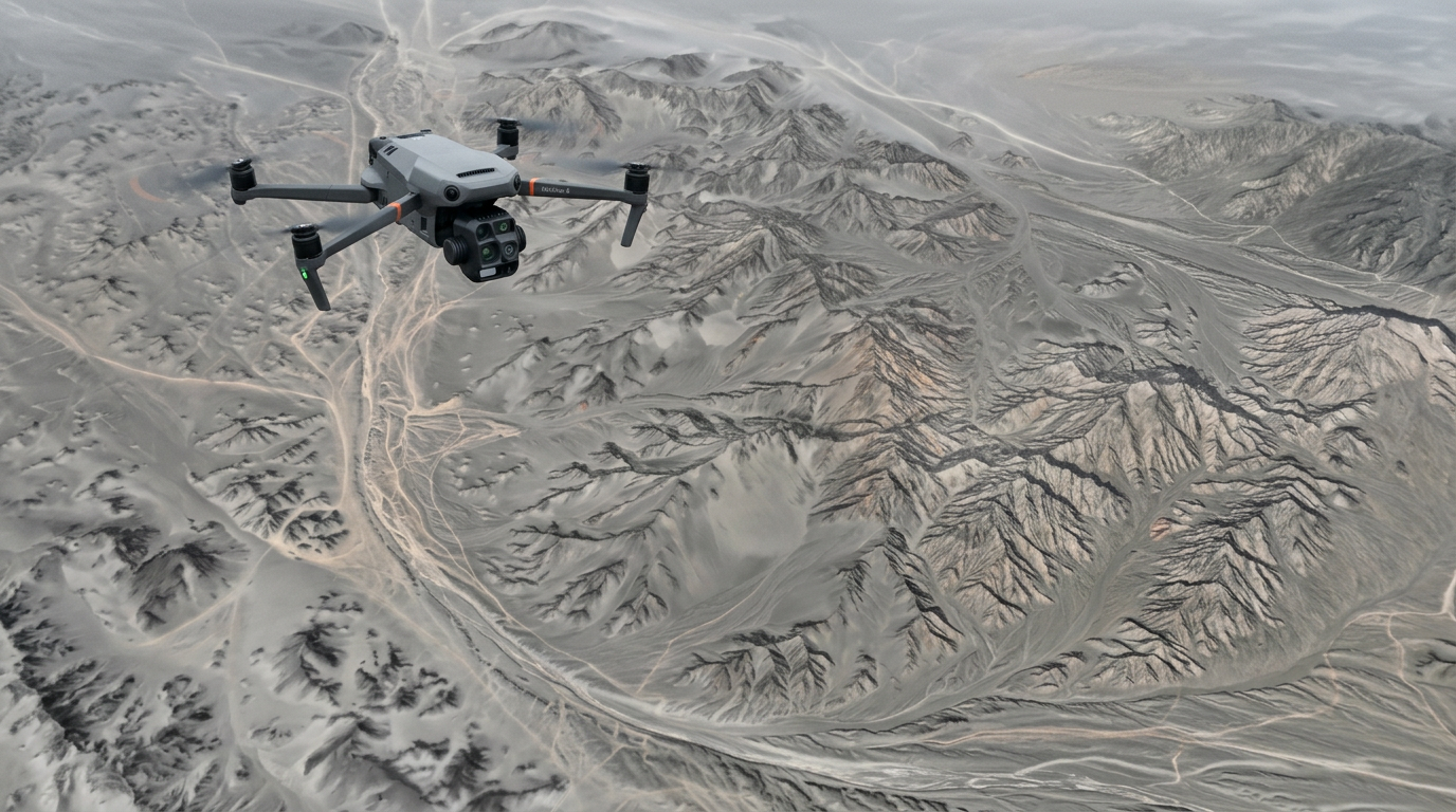
Slope stability work needs repeatable data across high walls, tailings dams, and waste rock without putting a surveyor at the toe of a face. The 4E's RTK-tagged photogrammetry produces point clouds for change detection between captures, and the 112x hybrid zoom lets an operator inspect a face in detail from a safe standoff.
Why it matters: point-cloud change detection across faces and dams, from a safe standoff.
4. Survey-Grade Deliverables
Mine survey data is only useful if it lands in your planning stack. The 4E's RTK-tagged imagery processes in DJI Terra, LiDAR360, or third-party software into orthos, DSMs, DTMs, and classified point clouds, exportable as LAS/LAZ, DXF, GeoTIFF, and ASCII for MineSight, Deswik, Vulcan, Surpac, and Leapfrog reconciliation workflows.
Why it matters: deliverables that drop straight into your mine-planning software, in your coordinate system.
5. Aggregate & Quarry Site Mapping
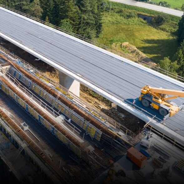
Quarries and aggregate operations need frequent, low-cost site mapping for inventory and planning. The 4E's fast deployment and 49-minute endurance make a whole-site capture a quick, repeatable task rather than a scheduled survey mobilization.
Why it matters: frequent whole-site mapping without mobilizing a survey crew each time.
6. Remote-Pit Survey Without a Base Station
Remote pits and greenfield exploration sites often have no established RTK base. Custom Network RTK connects to an NTRIP server over cellular or Wi-Fi, or set up your own on-site reference with the DJI D-RTK 3 Multifunctional Station for centimetre positioning where there's no network coverage.
Why it matters: survey-grade positioning on a remote pit with no infrastructure yet.
Where the 4E Stops and the Bigger Platforms Start
The Matrice 4E is a photogrammetry aircraft with a 200 g payload allowance — it does not carry gimbal payloads. For the mining jobs that need a dedicated sensor, the heavier Matrice 400 is the companion platform: a 6 kg payload airframe that carries survey LiDAR and GPR payloads the 4E can't lift, with IP55 weather sealing and a -20°C envelope for year-round work. Most mine programs run the two together — the 4E for fast daily photogrammetry, the M400 for LiDAR and heavy sensors. We deploy all of them:
| Job | Right platform | Why |
|---|---|---|
| RTK photogrammetry, stockpiles, pit progression | Matrice 4E | Fast-deploy mapping camera, 1 cm RTK |
| Aerial LiDAR (dense, penetrates vegetation) | Matrice 400 + LiDAR payload | Long-range, high-density point clouds |
| Drone GPR (voids, overburden, utility locate) | GPR array on the Matrice 400 | Payload weight beyond the 4E |
| Underground / confined-space SLAM | Boston Dynamics Spot + ground SLAM | GPS-denied drifts, shafts, stopes |
We scope the mix against your deposit and deliverables rather than force one aircraft onto every job — ask us about the right platform for LiDAR or GPR alongside your 4E.
Does the Cold and Weather Affect Operations?
It's a real planning factor on a working mine site, and it comes down to two things: temperature and ingress protection.
Temperature. The Matrice 4E is rated to -10°C, and its Intelligent Flight Battery does not support low-temperature charging. For Canadian winter work, keep batteries warm until launch and plan shorter flights in the cold.
Ingress protection. This is the one to plan around on a dusty pit or in wet weather: the standard Matrice 4E (and 4T) carry no official IP rating — DJI lists "no standard protection level" — so they shouldn't be flown in anything beyond incidental light moisture, and heavy airborne dust is a real consideration around haul roads and crushers. If year-round, all-weather capture is central to your program, the Matrice 4D / Matrice 4TD is the answer: these are the IP55-rated variants of the Matrice 4 Series, sealed against dust and sustained water jets and rated to a much colder -30°C. The 4D/4TD can be operated as standalone manually piloted aircraft or deployed in the DJI Dock 3 for automated, recurring capture — so the same weather-hardened platform covers both piloted survey flights and pilot-free scheduled site captures. On a Canadian mine that has to keep capturing through dust, rain, and deep cold, that IP55 rating is the difference between a program that runs year-round and one that stands down when conditions turn.
For sustained sub-zero, dusty, or wet-weather programs, we'll be straight with you about whether the standard 4E or the IP55-rated, weather-hardened 4D/4TD is the right platform for your site and cadence.
What About Flying Over Crews and Active Faces?
Mine sites have crews working below flight paths, and the rules run through Transport Canada, not the spec sheet. At about 1.2 kg the Matrice 4E sits well within the small-RPAS class, so operating near or over people is an advanced operation under CARs Part IX. That requires a pilot certified for Advanced Operations, NAV CANADA authorization in controlled airspace, and a valid RPAS Safety Assurance declaration for that operation. We handle RPAS Advanced certification, BVLOS pathways, airspace authorization, and SFOC support — ask us to scope the regulatory footing for your site.
On parachutes for over-people flight: a deployable parachute is a recognized ground-risk mitigation for flying over uninvolved people. For the Matrice 4E we supply the AVSS Parachute Recovery System for the DJI Matrice 4 Series — a 149 g bolt-on that mounts without interfering with the aircraft's GPS, deploys in under 0.5 seconds, integrates a flight-termination system that cuts the motors on activation, and brings the aircraft down at a controlled ~3.8 m/s. It ships with the compliance documentation (ASTM F3322 / EASA MOC) that supports operations over people, and is designed to support Transport Canada frameworks for flight over people. If flying near crews or over uninvolved people is part of your survey work, we'll scope the parachute into your operational approvals — ask us to confirm the current Canadian regulatory pathway.
Common Questions
Is the Matrice 4E good for stockpile volumetrics?
Yes — its 4/3-inch mechanical-shutter camera produces distortion-free imagery for accurate photogrammetry, and RTK to 1 cm ties volumes to your datum. It's the fast-deploy tool for repeatable stockpile and pit surveys.
Can the Matrice 4E carry a LiDAR sensor or a GPR array for mining?
No — the 4E has a 200 g payload allowance and no gimbal-payload port. Aerial LiDAR and drone GPR run on the heavier DJI Matrice 400 (6 kg payload) with a dedicated gimbal payload. We deploy the M400 alongside the 4E where the job needs it.
Do deliverables work with our mine-planning software?
Yes — exports in LAS/LAZ, DXF, GeoTIFF, and ASCII for MineSight, Deswik, Vulcan, Surpac, and Leapfrog, processed through DJI Terra or LiDAR360.
Can you do underground or confined-space scanning?
Yes — that's a ground-robot job. Boston Dynamics Spot with a SLAM payload handles drifts, shafts, and stopes where GPS doesn't work; the 4E covers the open-pit aerial survey.
Does the Matrice 4E need a base station for RTK?
No. Custom Network RTK connects to an NTRIP server over cellular or Wi-Fi, and the platform is compatible with the DJI D-RTK 3 Multifunctional Station for remote pits without existing survey infrastructure.
The Bottom Line for Canadian Mine & Survey Teams
The Matrice 4E is the fast-deploy, survey-grade photogrammetry tier of a mine survey program: a 4/3-inch mechanical-shutter camera for accurate reconstruction, RTK to 1 cm for reconcilable data, and 49-minute flights in a folding 1.2 kg airframe that launches in minutes. It's the right tool for stockpile volumetrics, pit and bench progression, and slope photogrammetry — with aerial LiDAR, GPR, and underground SLAM running on the heavier Matrice 400 and ground platforms alongside it.
Two things to settle before you commit: match the platform to the job (4E for photogrammetry and volumetrics, the Matrice 400 for LiDAR and GPR, Spot for underground), and plan around the -10°C cold-weather envelope for Canadian winter work.
If you're scoping a mine or survey program, request a proposal. Tell us the deposit, deliverable cadence, and software stack, and we'll come back with a hardware and processing proposal.
Matrice 4T vs 4E vs 4TD: Which DJI Matrice 4 Is Right for Mining & Surveying?
DJI's Matrice 4 Series comes in variants that look nearly identical but do different jobs. Here's how they line up for a mine, quarry, or survey program — and when each earns its place.
The Short Version
- Matrice 4E — the mapping aircraft. Choose it for stockpile volumetrics, pit progression, and slope photogrammetry.
- Matrice 4T — the inspection aircraft. Choose it for thermal work, equipment checks, and site awareness.
- Matrice 4TD — the IP55, all-weather version of the 4T. Flies standalone or in the DJI Dock 3 for automated, recurring captures, and holds up in dust, rain, and deep cold.
Side-by-Side for Mining & Surveying
| Feature | Matrice 4E | Matrice 4T | Matrice 4TD |
|---|---|---|---|
| DJI's intended use | Surveying, mapping, mining | Inspection, public safety, thermal | All-weather + docked autonomous operations |
| Wide camera | 4/3-inch, 20 MP, mechanical shutter | 1/1.3-inch, 48 MP (no mechanical shutter) | Same as 4T |
| Thermal camera | None | 640 × 512 radiometric | 640 × 512 radiometric |
| Laser rangefinder | — | 1,800 m | 1,800 m |
| IP rating | No standard rating | No standard rating | IP55 (dust + water jets) |
| Operating temperature | -10°C to 40°C | -10°C to 40°C | Down to -30°C |
| Best for | Volumetrics, pit progression, slope photogrammetry | Equipment thermal, site awareness, security | All-weather + scheduled, pilot-free recurring captures |
| Deployment | Manual pilot deployment, fast setup | Manual pilot deployment, fast setup | Manually piloted or in the DJI Dock 3 |
| Payload | 200 g (no gimbal payloads) | 200 g (no gimbal payloads) | 200 g (no gimbal payloads) |
| RTK accuracy | 1 cm + 1 ppm | 1 cm + 1 ppm | 1 cm + 1 ppm |
None of the Matrice 4 variants carry gimbal payloads like a LiDAR sensor — that's the Matrice 400's role. The 4TD is the IP55-rated, weather-hardened variant of the Matrice 4 Series — it can be flown standalone or deployed in the DJI Dock 3. Exact configuration and Canadian availability are quote-only.
Which One for Your Site?
Choose the Matrice 4E if your core need is measurable survey data — stockpile volumetrics, weekly pit and bench progression, slope photogrammetry, and reconciliation deliverables. The mechanical-shutter mapping camera is the reason this is the survey aircraft.
Choose the Matrice 4T if your need is thermal and awareness — hot-spot detection on equipment or spoil piles, site overwatch, and security. The thermal camera and laser rangefinder set it apart.
Choose the Matrice 4TD if you need all-weather capability (IP55, down to -30°C) or the 4T's sensors running on a schedule — it flies standalone or from the DJI Dock 3 for recurring site captures or security sweeps with no pilot dispatched each time.
And for the heavy survey jobs — aerial LiDAR, drone GPR, or underground SLAM — the platform is the heavier Matrice 400 or a ground robot like Spot, not the Matrice 4 Series. Most mine programs pair a 4E for day-to-day photogrammetry with an M400 for LiDAR — talk to us about the right combination.
Not sure which fits? Talk to us — tell us your deposit and deliverable cadence, and we'll scope the right combination rather than sell you one aircraft for every job.
Comparing platforms? See the pillar guide: DJI Drones for Mining & Surveying: The Complete Canadian Guide.
Sources
- DJI Matrice 4 Series specifications: enterprise.dji.com/matrice-4-series/specs
- DJI Matrice 4 Series User Manual (cameras, mechanical shutter, RTK, sensing, transmission)
- Transport Canada, Drone operation categories and pilot certificates: tc.canada.ca
Shop the story
Related products in our catalog
Every product below is stocked and supported by Remote Robotic in Canada.
- DJI Matrice 4E
DJI Matrice 4E
Compact mapping-first M4 Series with wide + medium-tele + tele cameras and laser rangefinder.
View product → - DJI Matrice 4T
DJI Matrice 4T
Multi-sensor M4 Series with thermal + NIR + laser rangefinder for inspection & public safety.
View product → - DJI Matrice 4TD
DJI Matrice 4TD
Dock-native thermal M4TD with NIR aux light — night-ops DFR and thermal patrol.
View product → - DJI Matrice 400
DJI Matrice 400
Flagship enterprise M400 airframe — 59 min flight, 6 kg payload, multi-sensor ready.
View product → - DJI Zenmuse L3
DJI Zenmuse L3
1535 nm long-range LiDAR + dual 100 MP RGB — survey-grade M400 mapping payload.
View product → - D-RTK 3 Multifunctional Station
D-RTK 3 Multifunctional Station
Cm-level GNSS base / rover / relay — foundation of any M400 survey workflow.
View product → - DJI AP100 Parachute
DJI AP100 Parachute
Certified recovery parachute for the M400 — the enabler for flight over people workflows.
View product →