Industrial Brief
DJI Dock 3 for Survey & Mapping: Automated Recurring RTK Photogrammetry
The DJI Dock 3 for survey & mapping — automated recurring RTK photogrammetry with the Matrice 4D. IP56 dock, -30°C, vehicle-mountable, 1 cm RTK, FlightHub 2. Verified specs and Canadian survey use cases.
Remote Robotic · July 28, 2026 · 8 min read
Last verified against DJI's published Dock 3 specifications: July 2026.
Why the Dock 3 Fits Survey & Mapping
Most survey work is a one-time capture: mobilize, fly, process, deliver. But a growing share of survey is recurring — construction progress every week, stockpile volumes every month, slope or shoreline change over a season, site monitoring on a fixed cadence. For that work, the cost isn't the survey; it's mobilizing a crew or a pilot to the same site over and over. A dock removes that cost by putting a survey-grade aircraft on site permanently: it launches on schedule, flies the identical mission every time, and delivers RTK-tagged data to the office automatically.
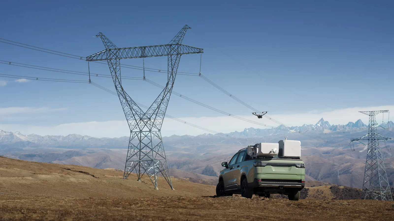
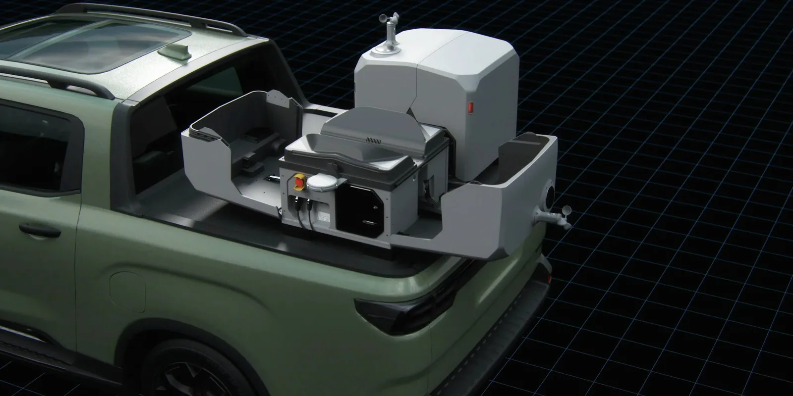
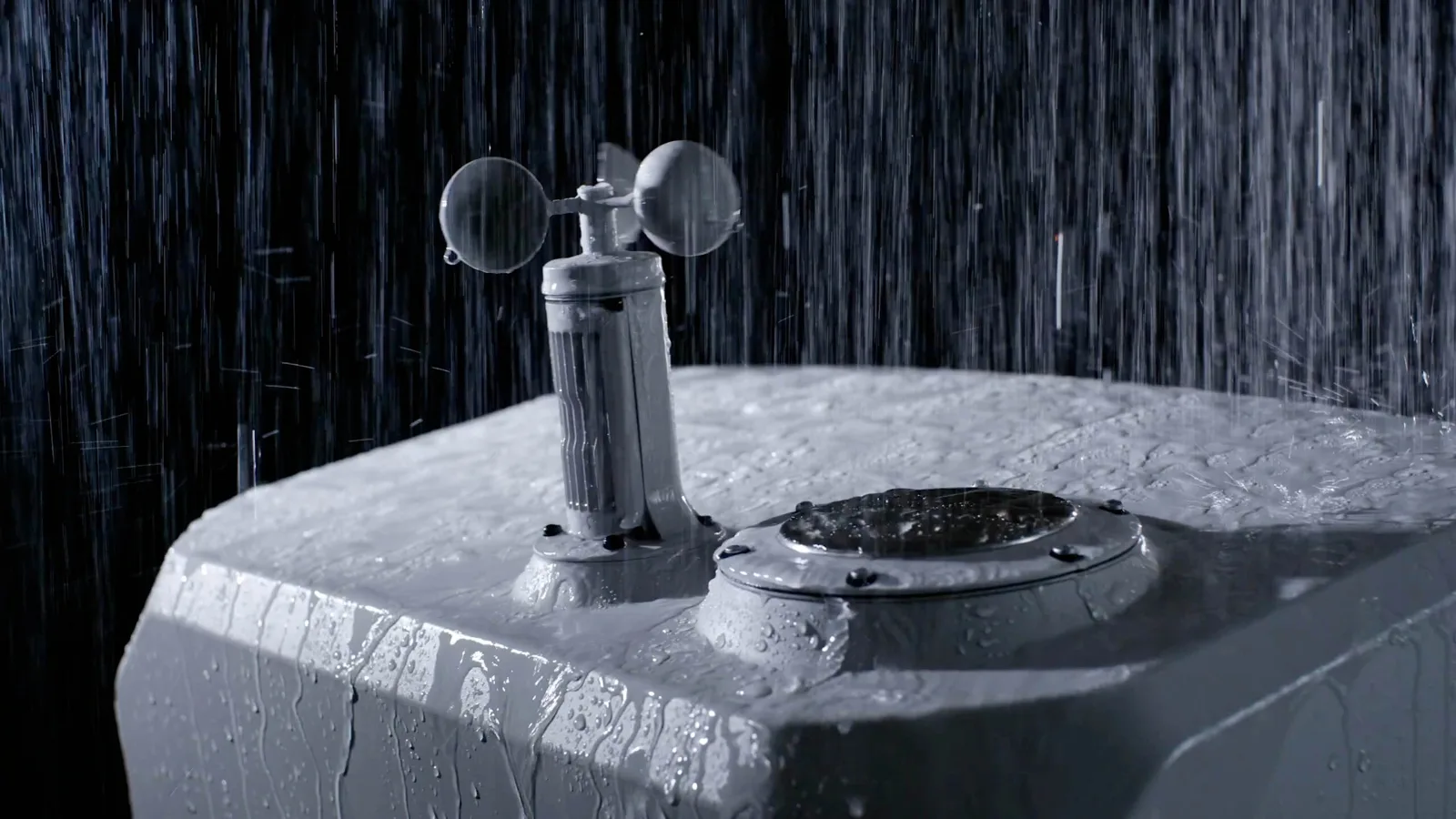
The Dock 3 is built for the conditions that make recurring Canadian survey hard to sustain. It carries an IP56 ingress rating, operates from -30°C to 50°C, and includes onboard wind, rain, temperature, and water-immersion sensors so it only launches when conditions are safe. A backup battery keeps it running over 4 hours through a power interruption, it charges the aircraft from 15% to 95% in 27 minutes, and it can be vehicle-mounted to reposition between sites or corridors. Through DJI FlightHub 2, one survey office can run recurring capture across multiple docks.
The Operational Advantage
| Survey job | What the Dock 3 brings | Platform / catalog |
|---|---|---|
| Recurring monitoring survey | Scheduled RTK photogrammetry, identical mission each time | DJI Dock 3 + Matrice 4D |
| Progress & change detection | Automated captures for week-over-week comparison | Matrice 4D (4/3-inch mapping camera) |
| Volumetric tracking | Fixed-cadence stockpile and earthwork volumes | Matrice 4D + RTK |
| Remote-site & corridor monitoring | Aircraft lives on site; 10 km operating radius | DJI Dock 3 |
| Rapid response capture | Launch-on-demand survey from the office | FlightHub 2 |
| Base-station-free RTK | Centimetre positioning without a network | DJI D-RTK 3 Multifunctional Station |
| High-density aerial LiDAR | Long-range, vegetation-penetrating point clouds | DJI Matrice 400 + LiDAR |
DJI Dock 3 & Matrice 4D Key Specifications
| Specification | DJI's published figure |
|---|---|
| Dock — ingress protection | IP56 |
| Dock — operating temperature | -30°C to 50°C |
| Dock — weight | 55 kg (without aircraft) |
| Dock — backup battery life | > 4 hours |
| Dock — aircraft charge time | 27 min (15% to 95%) |
| Dock — max landing wind speed | 12 m/s |
| Dock — onboard sensors | Wind, rainfall, ambient temp, water immersion |
| Dock — deployment | Fixed or vehicle-mounted |
| Dock — management software | DJI FlightHub 2 (and On-Premises) |
| Aircraft (Matrice 4D) — IP rating | IP55 |
| Aircraft — operating temperature | -20°C to 50°C |
| Aircraft — max flight time | 54 min |
| Aircraft — max hovering time | 47 min |
| Aircraft — max operating radius (from dock) | 10 km |
| Aircraft — max flight distance | 43 km |
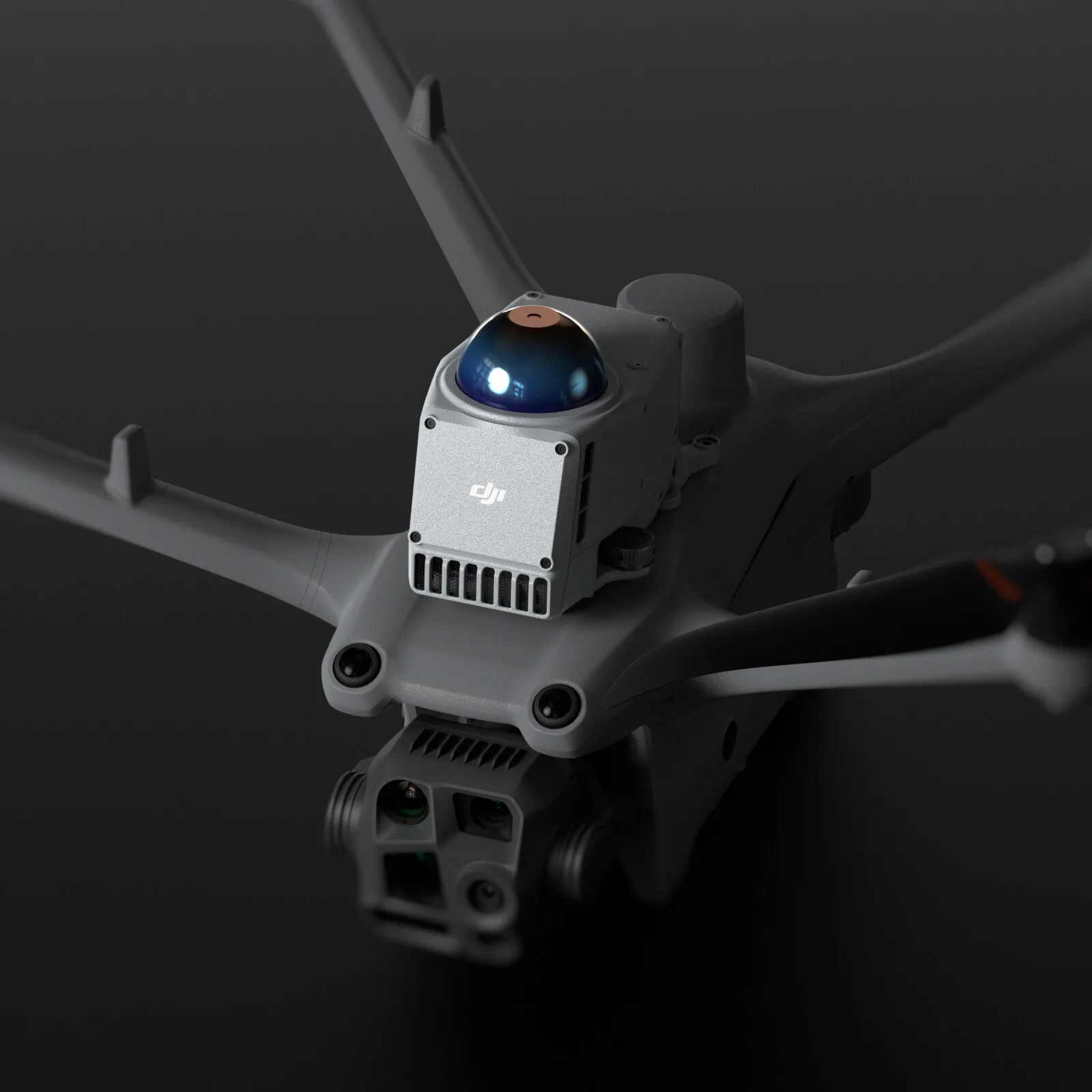
| Aircraft — wide (mapping) camera | 4/3-inch CMOS, 20 MP, mechanical shutter |
| Aircraft — medium tele / tele | 48 MP; 112x hybrid zoom |
| Aircraft — RTK positioning | 1 cm + 1 ppm; hovering ±0.1 m |
| Aircraft — GNSS | GPS + BeiDou + Galileo + QZSS + GLONASS |
| Aircraft — battery | 149.9 Wh, 400-cycle, low-temp self-heating |
| Aircraft — transmission | DJI O4+ Enterprise; 25 km FCC / 12 km CE |
Per DJI's footnotes, flight and range figures were measured in controlled, windless conditions and are reference data — real-world numbers vary with wind, altitude, and firmware. Note the useful distinction for Canadian operators: the dock is IP56 and rated to -30°C, while the docked Matrice 4D aircraft is IP55 and rated to -20°C with a self-heating battery — a genuinely all-weather survey pairing. (The Dock 3 also flies the thermal Matrice 4TD; for survey and mapping the 4D's mechanical-shutter mapping camera is the relevant aircraft.)
What Can the Dock 3 Do for a Survey Program?
Six jobs cover where a dock earns its place in a Canadian survey and mapping operation. Each maps to a specific, verified capability.
1. Recurring Monitoring Survey
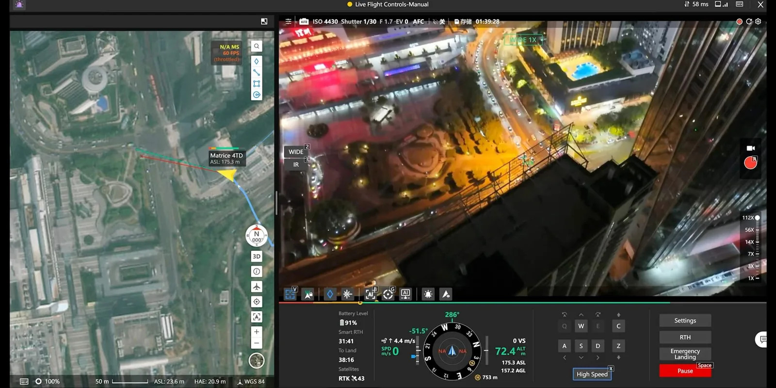
Sites that need surveying on a schedule — construction, extraction, restoration, coastal or slope monitoring — are where a dock changes the economics. The Dock 3 runs the Matrice 4D on a fixed cadence, flying the identical photogrammetry mission each time, so every capture is directly comparable and tied to your datum by RTK (1 cm + 1 ppm). Monitoring becomes a standing dataset rather than a series of mobilizations.
Why it matters: turn repeat-visit monitoring into an automated, comparable dataset without mobilizing a crew each time.
2. Progress & Change Detection
Construction progress, reclamation, and earthworks all depend on comparing this week to last. Automated dock captures flown the same way every time produce orthomosaics and surface models that align cleanly for change detection, so movement, progress, and discrepancies show up as measurable differences rather than eyeballed impressions.
Why it matters: clean week-over-week change detection from captures flown identically every time.
3. Volumetric Tracking
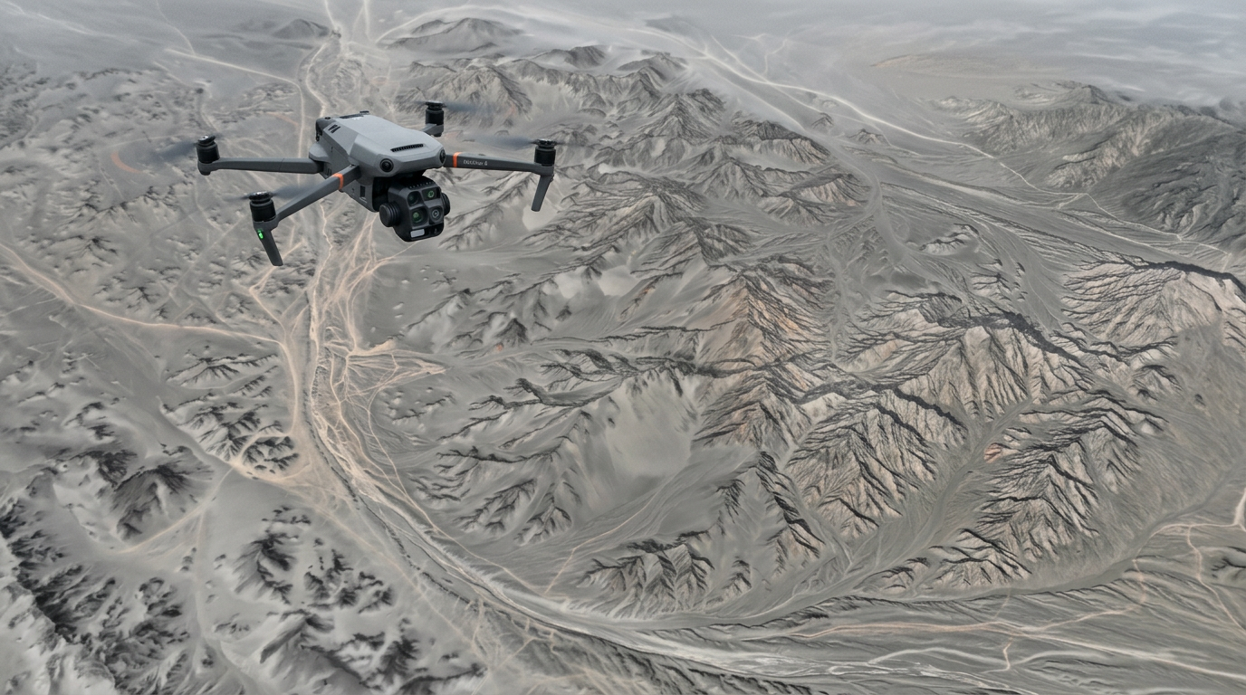
Stockpiles, borrow pits, and material inventories need volumes tracked on a cadence. The 4D's mechanical-shutter mapping camera produces distortion-free imagery for accurate photogrammetric reconstruction, and RTK ties every volume to your coordinate system — so a dock delivers a continuous volumetric record without scheduling a survey visit for each cycle.
Why it matters: volumes on a reliable cadence, tied to your datum, with no per-cycle mobilization.
4. Remote-Site & Corridor Monitoring
The dock's economics are strongest where mobilization is hardest. With a 10 km operating radius and vehicle-mounted deployment, the Dock 3 monitors remote sites, active corridors, and segments that would otherwise be surveyed only occasionally — and a vehicle-mounted dock can leapfrog along a corridor or move to a new site.
Why it matters: routine coverage of the remote sites and corridor segments that are too far to survey often by crew.
5. Rapid Response Capture
When a site event happens — a washout, a slope movement, storm damage, a construction incident — the Dock 3 can launch an immediate survey from the office, giving the team current, measurable imagery within minutes instead of waiting for the next scheduled visit.
Why it matters: current, survey-grade imagery within minutes of a site event.
6. Multi-Site Survey Programs From One Office
A single survey office can run docks across many sites through FlightHub 2, standardizing capture parameters, cadence, and deliverable formats. That turns recurring survey from a scheduling problem into a managed fleet program with consistent, comparable data across every site.
Why it matters: one office runs recurring survey across every site, with standardized, comparable data.
Where the Dock 3 Fits in a Survey Fleet
The docked Matrice 4D is a survey-grade photogrammetry aircraft — excellent for automated, recurring RTK capture — but it does not carry gimbal payloads, so it doesn't replace the specialist survey systems in your fleet. It complements them:
| Survey job | Right platform | Why |
|---|---|---|
| Recurring / monitoring RTK photogrammetry | DJI Dock 3 + Matrice 4D | Automated, fixed-cadence mapping camera |
| High-density aerial LiDAR (canopy penetration) | Matrice 400 + Zenmuse L3 or GreenValley LiAir | Multi-return LiDAR for forested and bare-earth models |
| Long-linear corridor survey | DeltaQuad Evo fixed-wing VTOL | 100+ km per mission for ROW, transmission, roads |
| GPS-denied / underground / indoor | GreenValley LiGrip SLAM or Leica BLK ARC on Spot | No GNSS dependency in shafts, drifts, dense forest |
Most survey programs use a dock for the recurring, automated photogrammetry layer and keep LiDAR, corridor VTOL, and SLAM as their specialist tools. We scope the mix against your accuracy spec, terrain, and deliverables — ask us about adding a dock to your survey fleet.
The IP Rating Advantage in Canadian Conditions
Weather is what breaks a recurring survey cadence, and it's where a dock deployment is strongest. The Dock 3 carries an IP56 rating and operates from -30°C to 50°C, sealed against dust and powerful water jets, with onboard wind, rain, and water-immersion sensors that hold a launch when conditions are unsafe. The docked Matrice 4D is IP55 and rated to -20°C, with a low-temperature self-heating battery — so the aircraft itself is built for the cold, unlike the standard handheld Matrice 4E / Matrice 4T (which carry no IP rating and shouldn't fly in rain). For a Canadian survey program, that pairing is what makes a genuinely year-round, all-weather automated capture cadence realistic rather than a fair-weather experiment.
What About Flying Over People?
Survey routes over active sites or populated areas can mean flying over people not involved in the operation, and the rules run through Transport Canada, not the spec sheet. Operating near or over people is an advanced operation under CARs Part IX, requiring a pilot certified for Advanced Operations (dock operations are still conducted under a certificate and a valid RPAS Safety Assurance declaration), NAV CANADA authorization in controlled airspace, and a specific operational approval. Dock and BVLOS operations in particular need a documented compliance case — we support Transport Canada Advanced Operations, BVLOS pathways, airspace authorization, and SFOC applications, and we scope the dock-specific approvals with you.
Parachute for over-people flight: where a route takes the aircraft over uninvolved people, a deployable parachute is the recognized ground-risk mitigation. For the Matrice 4 Series we supply the AVSS Parachute Recovery System — a lightweight bolt-on that deploys in under 0.5 seconds, cuts the motors on activation, and brings the aircraft down at a controlled descent, shipping with ASTM F3322 / EASA MOC documentation that supports operations over people. Parachute integration on a docked 4D is configuration-specific, so we confirm the exact setup and the current Canadian regulatory pathway as part of scoping your deployment.
Common Questions
What is the DJI Dock 3 for survey?
It's an IP56, weather-hardened autonomous drone dock that houses a Matrice 4D mapping aircraft and runs scheduled or on-demand RTK photogrammetry flights with no pilot on site, managed through DJI FlightHub 2. It supports both fixed and vehicle-mounted deployment, and is best suited to recurring, monitoring, and change-detection survey.
Can a dock replace our LiDAR or corridor survey systems?
No — the docked Matrice 4D is a photogrammetry aircraft and doesn't carry gimbal payloads. High-density aerial LiDAR runs on the Matrice 400 with a Zenmuse L3 or GreenValley LiAir; long-linear corridors run on a DeltaQuad Evo VTOL; GPS-denied capture runs on GreenValley LiGrip or a Leica BLK ARC. A dock adds an automated photogrammetry layer alongside those.
Can the Dock 3 survey in a Canadian winter?
Yes. The dock is rated to -30°C and IP56; the docked Matrice 4D is IP55, rated to -20°C, and has a low-temperature self-heating battery. Onboard weather sensors hold launches when wind or precipitation exceed safe limits.
How accurate is dock-based survey?
The Matrice 4D positions to 1 cm + 1 ppm with RTK and holds ±0.1 m hovering accuracy, using its 4/3-inch mechanical-shutter mapping camera — survey-grade for photogrammetric deliverables. Pair with a DJI D-RTK 3 base station or Network RTK for positioning without existing infrastructure.
How far can the drone fly from the dock?
DJI publishes a 10 km operating radius and a 43 km max flight distance for the docked aircraft, subject to conditions and regulatory limits.
The Bottom Line for Canadian Survey Teams
The DJI Dock 3 adds the one capability a conventional survey fleet lacks: automated, recurring, pilot-free RTK photogrammetry, built for Canadian conditions. An IP56, -30°C dock houses an IP55 Matrice 4D with a 4/3-inch mechanical-shutter mapping camera and 1 cm RTK, managed from the office through FlightHub 2. It's the right tool for monitoring survey, progress and change detection, and volumetric tracking on a fixed cadence — while high-density LiDAR, corridor VTOL, and GPS-denied SLAM stay on their specialist platforms.
Two things to settle before you commit: position the dock as your recurring-photogrammetry layer alongside your LiDAR and corridor systems, not a replacement for them, and scope the Transport Canada compliance case for dock and BVLOS operations early — that's the long pole in a dock deployment, and we handle it with you.
If you're evaluating automated survey for recurring or remote sites, request a proposal. Tell us your survey area, cadence, accuracy spec, and deliverable format, and we'll scope dock siting, aircraft, compliance, and processing.
Matrice 4T vs 4E vs 4TD/4D: Which DJI Matrice 4 Is Right for Survey?
The Dock 3 flies the Matrice 4D/4TD, but it's worth understanding how the whole Matrice 4 family lines up for survey — because the right answer is often a mix of handheld and docked aircraft.
The Short Version
- Matrice 4E — the handheld mapping aircraft. Choose it for on-demand, crew-carried survey and mapping.
- Matrice 4T — the handheld inspection aircraft. Choose it for thermal and visual asset inspection, not mapping.
- Matrice 4D / Matrice 4TD — the docked versions, IP55 and weather-hardened, flown by the DJI Dock 3 for automated, recurring capture. The 4D is the mapping variant for survey; the 4TD is the thermal variant.
Side-by-Side for Survey & Mapping
| Feature | Matrice 4E | Matrice 4T | Matrice 4D / 4TD (Dock 3) |
|---|---|---|---|
| Role | Handheld mapping | Handheld inspection | Docked autonomous capture |
| Wide camera | 4/3-inch, 20 MP, mechanical shutter | 1/1.3-inch, 48 MP | 4D: 4/3-inch mechanical shutter · 4TD: 1/1.3-inch |
| Thermal camera | None | 640 × 512 radiometric | 4TD only: 640 × 512 |
| Mapping suitability | Survey-grade | Not a mapping camera | 4D: survey-grade |
| IP rating | No standard rating | No standard rating | IP55 (dock: IP56) |
| Operating temperature | -10°C to 40°C | -10°C to 40°C | -20°C to 50°C (dock: -30°C) |
| Max flight time | 49 min | 49 min | 54 min |
| RTK accuracy | 1 cm + 1 ppm | 1 cm + 1 ppm | 1 cm + 1 ppm |
| Deployment | Handheld | Handheld | Fixed or vehicle-mounted dock |
| Best for | On-demand mapping | Asset inspection | Recurring automated survey |
The 4D/4TD and their dock are the weather-hardened, autonomous tier. None of the Matrice 4 variants carry gimbal payloads; high-density LiDAR runs on the heavier Matrice 400, and corridor and GPS-denied survey run on VTOL and SLAM platforms. Exact 4D/4TD/Dock 3 configuration and Canadian availability are quote-only.
Which One for Your Program?
Choose the Matrice 4E if your need is on-demand, crew-carried survey — a surveyor takes it to a site for a one-time or occasional photogrammetric capture. The mechanical-shutter mapping camera makes it survey-grade.
Choose the Matrice 4T if your need is inspection rather than mapping — thermal and visual asset checks. It is not a survey mapping aircraft.
Choose a Dock 3 with the Matrice 4D if your need is recurring, pilot-free survey — monitoring, progress tracking, volumetric cadence, and change detection, run from the office in any weather.
And for the specialist survey jobs — high-density aerial LiDAR, long-linear corridor VTOL, or GPS-denied SLAM — the platforms are the heavier Matrice 400 with a LiDAR payload, a DeltaQuad Evo fixed-wing, or GreenValley LiGrip / Leica BLK ARC on Spot. Most survey programs run a dock for recurring photogrammetry and keep those specialist systems for the jobs only they can do.
Not sure which fits? Talk to us — tell us your survey area, cadence, and accuracy spec, and we'll scope the right combination rather than sell you one aircraft for every job.
Sources
- DJI Dock 3 specifications: enterprise.dji.com/dock-3/specs
- DJI Matrice 4D / Dock 3 User Manual (dock, aircraft, mapping camera, RTK, sensing, transmission)
- Transport Canada, Drone operation categories and pilot certificates: tc.canada.ca
Shop the story
Related products in our catalog
Every product below is stocked and supported by Remote Robotic in Canada.
- DJI Matrice 4D
DJI Matrice 4D
Dock-native M4D — IP55, ~54 min flight, pairs with Dock 3 for autonomous DFR & BVLOS.
View product → - DJI Matrice 4E
DJI Matrice 4E
Compact mapping-first M4 Series with wide + medium-tele + tele cameras and laser rangefinder.
View product → - DJI Matrice 4T
DJI Matrice 4T
Multi-sensor M4 Series with thermal + NIR + laser rangefinder for inspection & public safety.
View product → - DJI Matrice 400
DJI Matrice 400
Flagship enterprise M400 airframe — 59 min flight, 6 kg payload, multi-sensor ready.
View product → - DJI Zenmuse L3
DJI Zenmuse L3
1535 nm long-range LiDAR + dual 100 MP RGB — survey-grade M400 mapping payload.
View product → - D-RTK 3 Multifunctional Station
D-RTK 3 Multifunctional Station
Cm-level GNSS base / rover / relay — foundation of any M400 survey workflow.
View product →